
Description:
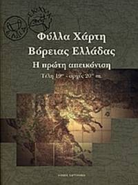
[Map sheets of Northern Greece - The First Depiction, End of 19th - Beginnings of the 20th Century]
In greek. Soft cover, 29x23 cm, 170 pp., ill.: colour maps. The first scientific illustration of Northern Greece, in the general map (Generalkarte) of the Empire of Franz Joseph.
==============================================================
The shipping cost estimated by the system covers books weighing up to 750 gr.; a surcharge depending on the actual weight and destination applies for heavier books.
