Description
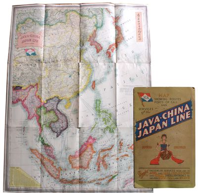
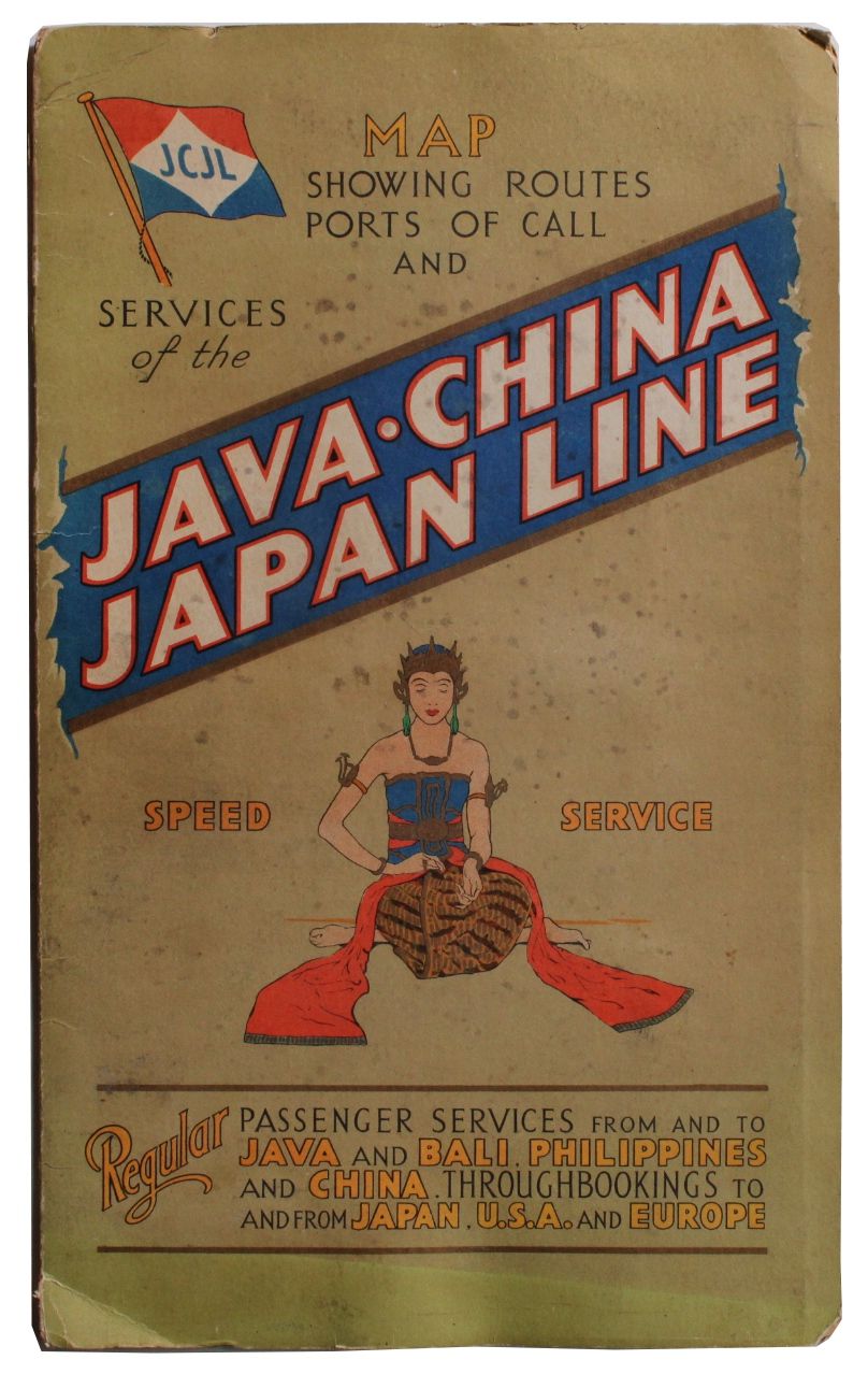
London, England: Stanford's Geog[raphica]l Estab[lishmen]t, 1931. Very good. Map measuring 44" x 33¼" partially glued down as issued to heavy card stock bifolium measuring 14¾" x 9" and with two pages of text and images on map's verso. Very good: minimal wear to the map which has a few insignificant spots of staining, a few small separations at intersections and a 3" jagged internal tear intersecting the large N and G in MONGOLIA. Bifolium with a 3" split at top of spine and ½" split at bottom, light spotting and edgewear; pages lightly toned with some dogears and scattered spotting. This is a large map of East Asia that doubled as a promotional for the Java-China-Japan Line (JCJL). JCJL was a Dutch-owned company, established in 1902 to serve the shipping routes between the Dutch East Indies, China and Japan. By 1931 JCJL had offices in Amsterdam and ten East Asian cities, with agencies at London, New York and San Francisco. Liners provided regular passenger service between Java and Bali, the Philippines and China, and through bookings to and from Japan, the United States and Europe. The large and multicolored map shows a wide swath of land and sea, with shipping routes and ports of call. Its upper left quadrant is dominated by China and Mongolia, with Japan in its upper right. Sumatra, Borneo, New Guinea and Java are at the bottom of the map, with the northernmost part of Australia peeking out in the lower right. The map also depicts existing railways as well as submarine telegraph cables and distances between major cities. The verso of the map contains company information and a photographic image of the M.S. Tjinegara, "one of the 'New Three'" ships built in 1931 for JCJL. There are also three images of the stately services on board a liner, showing a dining saloon, smoking room with library and a "two-bedded stateroom." A colorful and highly detailed map revealing the Dutch shipping enterprise in East Asia. OCLC shows three holdings.
NZ$1,405.81
Ships from Langdon Manor Books LLC (Texas, United States)