Click for full-size.


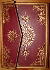
OTTOMAN ATLAS CONTAINS THIRTY NINE HAND COLORED MAPS PREPARED AND PRINTED IN THE MUHENDISHANE I BERRI HUMAYUN (THE ROYAL SCHOOL OF MILITARY ENGNEERING) IN ISTANBUL. POSSIBLY THE FIRST ADMINISTRATIVE ATLAS TO BE PRINTED IN USKUDAR AFTER THE ESTABLISHMENT OF THE TELEGRAPH LINES IN THE OTTOMAN WILAYAS (STATES)
by THE OTTOMAN AUTHORITY
- Used
- very good
- Hardcover
- Signed
- Condition
- Very Good
- Seller
-
Riyadh, Saudi Arabia
Payment Methods Accepted
About This Item
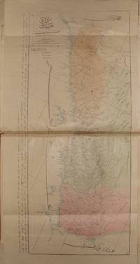
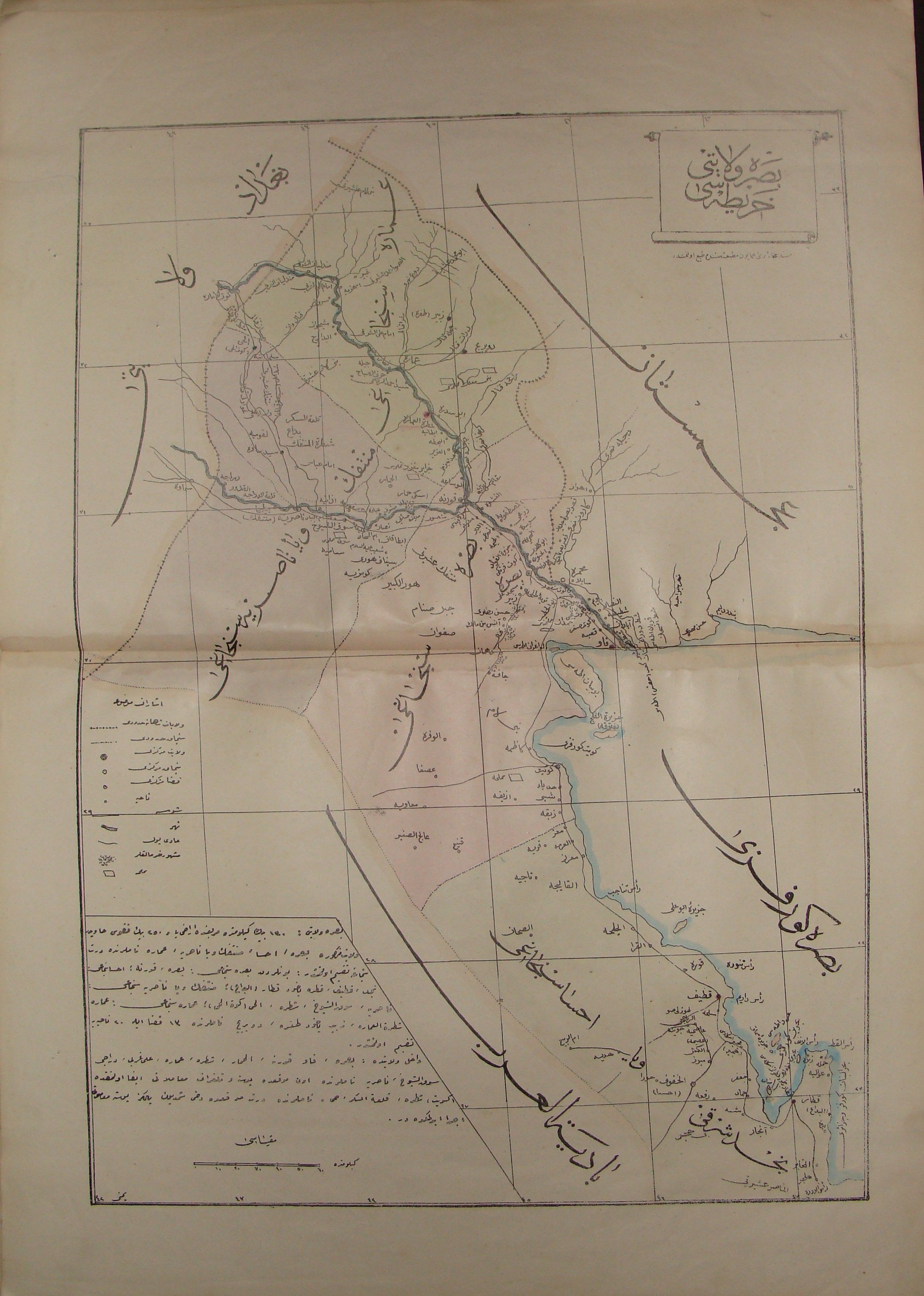
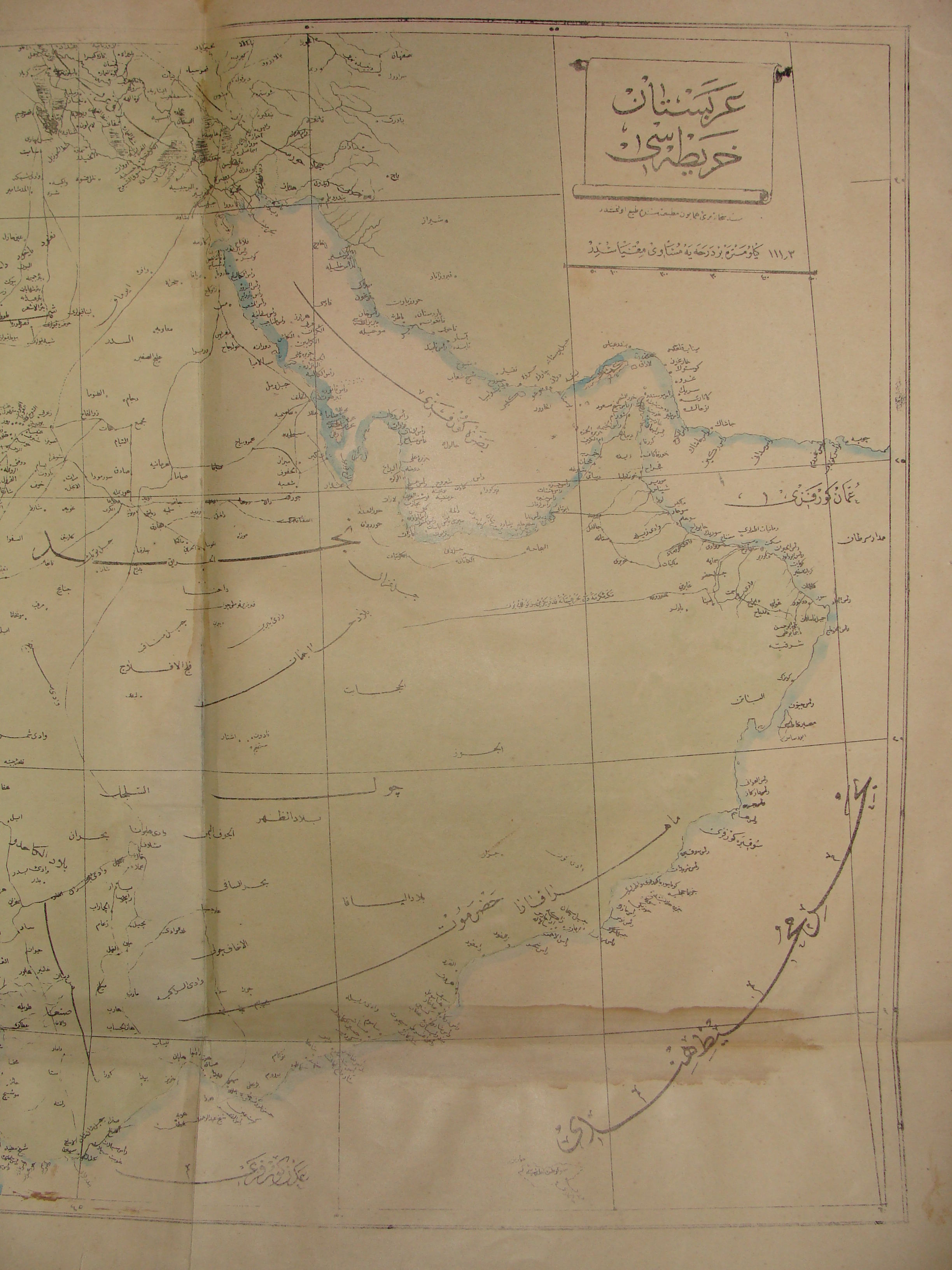
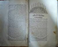
Uskudar: MuhendisHane-i Berr-i Humatun (The Royal school of military engneering) Atlas. Illus. by YUMNI. Very Good. Hardcover. Folio - over 12" - 15" tall. 1860's THIRTY NINE HAND COLORED MAPS MOSTLY SIGNED BY (YUMNI). MOST OF THEM ARE DESCRIBED IN THE OTTOMAN TURKISH. ALL MAPS ON DOUBLE PAGES, TITLED AND WITH PRINTING DETAILS. LATER HARD COVER. FOLIO 40 X 28 CM. SCARCE. the maps are the followings: (1)Arabistan (Arabian peninsula) 56 x 47 cm. (2)Tarablus Gharb wa tunus (Libya and Tunisia) 56 x 39 cm. (3)Tarablus Gharb (Libya) 56 x 40 cm. (4)Misir ayalet I mumtaza si (territory of Egypt) 56 x 46 cm. (5)Yemen 69 x 33 cm. (6)Hejaz, 56 x 39 cm. (7)Ankara . (8)Sivas . (9)Ma'muat ul Aziz. (10)Diyar Bekir. (11)Bitlis. (12)Erzurum . (13)Van. (14)Mosul 56 x 39 cm. (15)Bagdad 56 x 39 cm. (16)Basra 55 x 39 cm. (17)Zor mutasarrifligi (Part of Mesopotamia. (18)Halep (Aleppo). (19)Adana. (20)Konya. (21)Kibris (Cyprus). (22)Caza'ir I Bahr I Sefid (the Wilaya of the Mediterranean sea islands). (23)Aydin. (24)Pega mutasarriligi. (25)Izmit Mutasarrifligi and Hudavendigar Wilayati. (26)Trabzon. (27)Kastamonu. (28)Bulgaristan Eyalet I Mumtazesi (territory of Bulgaria). (29)Rum eli sharki (Eastern Rumelia) 56 x 39 cm. (30)Bosna (Bosnia). (31)Kosova (Kosovo). (32)Monastir (Monastery). (33)Ishkodra (Vilayet of Shkoder). (34)Yanya (Janina). (35)Selanik (Thessaloniki). (36)Edirne. (37)Istanbul. (38)Bahr I siyah bogaz I (Black sea channel). (39)Kal'ayi Sultaniyye bogazi (Kal'ayi Sultaniyye channel).
Reviews
(Log in or Create an Account first!)
Details
- Bookseller
- Archive
 (SA)
(SA)
- Bookseller's Inventory #
- 000444
- Title
- OTTOMAN ATLAS CONTAINS THIRTY NINE HAND COLORED MAPS PREPARED AND PRINTED IN THE MUHENDISHANE I BERRI HUMAYUN (THE ROYAL SCHOOL OF MILITARY ENGNEERING) IN ISTANBUL. POSSIBLY THE FIRST ADMINISTRATIVE ATLAS TO BE PRINTED IN USKUDAR AFTER THE ESTABLISHMENT OF THE TELEGRAPH LINES IN THE OTTOMAN WILAYAS (STATES)
- Author
- THE OTTOMAN AUTHORITY
- Illustrator
- YUMNI
- Format/Binding
- Hardcover
- Book Condition
- Used - Very Good
- Quantity Available
- 1
- Publisher
- MuhendisHane-i Berr-i Humatun (The Royal school of military engneering)
- Place of Publication
- Uskudar
- Keywords
- MAP,PLAN,OTTOMAN,OTTOMANO,TURKEY,TURKISH,MILITARY,OFFICIAL,HUMAYUN,HUMAYOUN,IMPERIAL,ROYAL,BERRI,USKUDAR,SULTAN,ISTANBUL,CONSTANTINOPLE,MUHENDISHANE,1860,1860's,ARABISTAN,ARABIA,ARAB,ARABE,ARABO,ATLAS,BAGDAD,BAGHDAD,BASRA,MOSUL,MUSOL,MUSUL,BASSORA,WIL
- Bookseller catalogs
- MILITARY; GEOGRAPHY; MAPS;
- Size
- Folio - over 12" - 15" tall
Terms of Sale
Archive
30 day return guarantee, with full refund including original shipping costs for up to 30 days after delivery if an item arrives misdescribed or damaged.
About the Seller
Archive
Biblio member since 2008
Riyadh
About Archive
In the meantime, We are looking to offer the most important materials in our collection which We've built during the past 20 years, While We are making to establish our publish house based on the Middle eastern political history studies.
Glossary
Some terminology that may be used in this description includes:
- Folio
- A folio usually indicates a large book size of 15" in height or larger when used in the context of a book description. Further,...
Frequently asked questions
This Book’s Categories

What is a professional bookseller?
Just about anyone can sell a book, but a professional bookseller knows the ins and outs of the rare book trade. Learn more!

What did people buy in 2020?
Plague journals, escapist literature, political history: explore our year in review, where we share rare book trends and a gallery of some of the most beautiful and interesting books sold in 2020.
Also Recommended
-
-
-

-
-

Save 10% on every purchase!
Join the Bibliophiles’ Club and start saving 10% on every book.
$29.95 / Year
