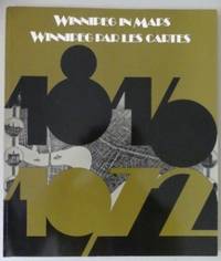
Description:
Ottawa: Public Archives of Canada, 1975. 80 pages. 10 1/2 in x 12 in. Fully illustrated with full page black and white maps and other cartographical items relating to Winnipeg. English and French. White pages and endpapers clean, good condition. Brown card cover lightly worn at edges and corners. VG. 1st Edition.
WINNIPEG IN MAPS, 1816-1972 / WINNIPEG PAR LES CARTES, 1816-1972. by Artibise, Alan F.J. And Dahl, Edward H - 1975
by Artibise, Alan F.J. And Dahl, Edward H
Similar copies are shown below.
Similar copies are shown to the right.

WINNIPEG IN MAPS, 1816-1972 / WINNIPEG PAR LES CARTES, 1816-1972.
by Artibise, Alan F.J. And Dahl, Edward H
- Used
- very good
- Paperback
- first
Ottawa: National Map Collection, Public Archives of Canada, 1975. 80 pp, 12 1/8" H. B&w maps. Bilingual text (English/French). "In this volume we present thirty-one maps, dating from 1816 to 1972, in the hope that those interested in Winnipeg's history will become aware of the wealth and variety of cartographical material available to them." Includes: Red River Settlement, 1816; Upper Fort Garry and Vicinity, 1848; Village of Winnipeg, 1872; Bird's Eye View of Winnipeg, 1880; Hudson's Bay Company's Reserve, 1887; Street Railways of Winnipeg, 1882-1914; Armstrong's Point, c.1905; Tuxedo Park, c.1910; Housing in the North End, 1917; Housing in the South End, 1930; Outline Map of St. Vital Park, 1929; Metropolitan Winnipeg, 1960, Unicity, 1972, etc. Interior - old price label on first page with light offset on inside of front cover, otherwise clean and tight with no previous ownership marks. Exterior - very minor edge wear on covers - light on spine, very light rubbing.. First Edition. Soft Cover. Very Good.
-
Bookseller
Capricorn Books
(CA)
- Format/Binding Paperback
- Book Condition Used - Very Good
- Edition First Edition
- Binding Paperback
- Publisher National Map Collection, Public Archives of Canada
- Place of Publication Ottawa
- Date Published 1975
- Keywords Winnipeg, Manitoba, Maps, Atlases, Red River Settlement, Fort Garry, Selkirk Settlement, Upper Fort Garry, Hudson's Bay Company Reserve, Bird's Eye Views, Street Railways, Residential Districts, Armstrong's Point, Crescentwood, North End, Ward
We have 5 copies available starting at NZ$49.30.

WINNIPEG IN MAPS, WINNIPEG PAR LES CARTES 1816 - 1972
by Artibise, Alan F.J. & Dahl, Edward H
- Used
- first
- Condition
- Used
- Edition
- 1st Edition
- Quantity Available
- 1
- Seller
-
Ottawa, Ontario, Canada
- Item Price
-
NZ$49.30
Show Details
Item Price
NZ$49.30

Winnipeg in Maps / Winnipeg Par Les Cartes 1816-1972
by Artibise, Alan F.J. (With Edward H. Dahl.)
- Used
- Paperback
- Condition
- Used
- Binding
- Paperback
- Quantity Available
- 1
- Seller
-
Winnipeg, Manitoba, Canada
- Item Price
-
NZ$72.03
Show Details
Description:
Ottawa: National Map Collection 1975. (4to paperback) Very good. 80pp. Maps, appendix, chronology. "Various collections across Canada, especially those in Ottawa and Winnipeg, contain four or five hundred maps and other cartographical items relating to the City of Winnipeg. Few of these documents have been used by other than a select group of researchers whose studies of Winnipeg's history have led them to the archives wherein these maps are deposited" - from the Preface. Parallel text in French and English. Locale: Manitoba; Prairie Provinces; Western Canada; Winniipeg-. (Manitoba, Cartography, Maps--Winnipeg).
Item Price
NZ$72.03

Winnipeg in Maps / Winnipeg Par Les Cartes 1816-1972
by Artibise, Alan F.J.; Edward H. Dahl
- Used
- Paperback
- first
- Condition
- Used
- Edition
- First printing
- Binding
- Paperback
- Quantity Available
- 1
- Seller
-
Toronto, Ontario, Canada
- Item Price
-
NZ$77.17
Show Details
Description:
Ottawa, Ontario, Canada: National Map Collection, Public Archives of Canada, 1975. First printing. Softcover. pp. 80. Square 4to. Illustrated card covers. Many black and white paps, appendix, chronology etc. Light rubbing to the covers, contents remain clean and unmarked with tight, sound binding; very good+. Text simultaneously in French and English.
Item Price
NZ$77.17
