Description:
Paris,: De l'Imprimerie de L.V. Thiboust,, 1704.. Books,""Description et explication des globes With the Arms of the Sun King Octavo. Contemporary speckled calf, gilt. In 1678 the Cardinal d'Estrées commissioned Vincenzo Coronelli to make an enormous pair of globes as an unparalled gift for Louis XIV: the celestial globe depicts the constellations as they would have been on the evening of Louis XIV's birth. This monumental pair - a terrestrial and a celestial globe - was constructed in Paris between 1681 and 1683, eventually measuring four metres in diameter, supported on bronze stands. To this day these globes remain unequalled in both beauty and technical prowess. The giant globes were originally intended for display at the equally opulent Palace of Versailles, but they were transferred to the King's Marly """"retreat"""" in 1703. Completely hidden in a thick forested valley, Marly took more than five years to complete. Louis XIV first visited in November 1683, but only stayed there for the…
Read More Search Results: Authors starting with L from Daniel Crouch Rare Books Ltd
You searched for:
- Bookseller inventory: Daniel Crouch Rare Books Ltd (authors starting with L)
- Bookseller: Daniel Crouch Rare Books Ltd
Results 1 - 20 of 36
More Photos
qui sont places dans les Pavillions du Chateaux de Marly.
by LA HIRE, Philippe de
- Used
- Condition
- Used
- Quantity Available
- 1
- Seller
-
London, United Kingdom
- Item Price
-
NZ$21,275.00NZ$31.91 shipping to USA
Show Details
Item Price
NZ$21,275.00
NZ$31.91
shipping to USA
![[Kent] A Mapp of the Downes](https://d3525k1ryd2155.cloudfront.net/h/891/909/1162909891.0.m.jpg)
[Kent] A Mapp of the Downes: Rare survey of Sandwich in Kent from an Actual Survey taken in 1736. With a Plan of the Harbour Propos'd in 1744. The Figures on the Sands denote the Depths at Low Water in Feet, and those without, the Depths at Low Water in Fathoms. The Roman Numbers she
by LABELYE, Charles
- Used
- Condition
- Used
- Quantity Available
- 1
- Seller
-
London, United Kingdom
- Item Price
-
NZ$2,127.50NZ$31.91 shipping to USA
Show Details
Description:
London,: Paul Fourdrinier,, 1744. 220 by 345mm. (8.75 by 13.5 inches).. Engraved map. Charles Labelye (1705-1762) was a Swiss engineer who settled in England, best known as the architect and builder of Westminster Bridge. However, he was also involved in various schemes for harbour improvements, notably those of Sandwich (1736-1737), Great Yarmouth (1747) and Sunderland (1748). His survey of Sandwich was published on his two-sheet 'A Mapp of the Downes much more correct than any hitherto published Shewing the true Shape, & Situation of the Coast between the North and South Forelands, & of all the adjacent Sands together with the Soundings at Low=Water, Places of Anchorage, & all the necessary leading Marks By Charles Labelye Engineer ...' (London, 1737), his plan being to extend the harbour at Sandwich so as to afford safe haven for ships in The Downs, and serve as a naval base in the event of war with France. Nothing came of the scheme, perhaps because of the distraction of his involvement with the…
Read More Item Price
NZ$2,127.50
NZ$31.91
shipping to USA

Taprobana.: The only map of Sri Lanka published by the Lafreri school
by [?LAFRERI, Antonio]
- Used
- Condition
- Used
- Quantity Available
- 1
- Seller
-
London, United Kingdom
- Item Price
-
NZ$6,382.50NZ$31.91 shipping to USA
Show Details
Description:
[Rome,: A. Lafreri,, c1570].. 264 by 200mm (10.5 by 7.75 inches).. Engraved map, watermark of a letter 'M' under star in shield. A striking map of Sri Lanka attributed to Antonio Lafreri. The map is typical of the Lafreri School with Venetian galleys on the stippled sea, cities and towns represented as bird's-eye views, and hills and trees populating the interior. Although the map is anonymous, the work has been attributed, by Destombes, to the Rome publisher Antonio Lafreri, who lists a map of Sri Lanka in his catalogue - item no. 75. La Barroni suggests that the map is a copy of an earlier map, published in Venice, however, there is no substantive evidence for this. The map would later be acquired by Claudio Duchetti, and then by Giacomo Gherardi, who advises it in his catalogue in 1598 (No.175 "isola tapproban"). The plate would then be purchased by Giovanni Orlandi, and finally by Hendrik van Schoel. Bifolco TAV. 86; cf. Woodward 316-318.
Item Price
NZ$6,382.50
NZ$31.91
shipping to USA

Capt. Parry's Discoveries in the Polar Regions, 1819-1820.: Rare broadsheet detailing one of the most important Arctic expeditions Compiled and Drawn, from the Admiralty Records, by W. Lane, Hydrographer and Teacher of Navigation, Naval Academy, 79, Leadenhall Street, London.
by LANE, W.
- Used
- Condition
- Used
- Quantity Available
- 1
- Seller
-
London, United Kingdom
- Item Price
-
NZ$13,828.75NZ$31.91 shipping to USA
Show Details
Description:
London, : Printed for, and Published by, Robert Blachford & Co., Chart Sellers to the Admiralty and Honorable East India Company, Navigation Warehouse, 79, Leadenhall Street,, [1821].. 685 by 470mm (27 by 18.5 inches). Engraved broadsheet, with two engraved maps, fine original hand-colour, paste-over to right-hand portion of 'Plan of Lancaster Sound', letterpress text below. A rare broadsheet comprising a letterpress title and two engraved maps; the North Pole map entitled 'Map of the North Polar Regions', the second entitled 'Plan of Lancaster Sound, penetrated by Capt. Parry, in July 1819'. The maps were edited from Admiralty Records by W. Lane, a teacher of navigation employed by Robert Blachford. The maps are set above an extensive panel of text of 'Interesting Particulars of the Voyage', recounting Parry's discoveries in the unsuccessful quest for a Northwest Passage, ending with his landfall in the Orkneys on 28th October 1820. Although Parry failed to find the elusive Northwest Passage, he…
Read More Item Price
NZ$13,828.75
NZ$31.91
shipping to USA

Nouveau Plan de la Ville de Bordeaux A L'Usage des Promeneurs Par Alfred Lapierre: An attractive plan of Bordeaux [with] Tableau des Voies de la Ville de Bordeaux et de la Banlieue.
by LAPIERRE, Alfred
- Used
- Hardcover
- Condition
- Used
- Binding
- Hardcover
- Quantity Available
- 1
- Seller
-
London, United Kingdom
- Item Price
-
NZ$1,276.50NZ$31.91 shipping to USA
Show Details
Description:
Bordeaux, : Feret & Fils, , 1888.. 565 by 710mm. (22.25 by 28 inches).. Lithographed map with original full colour, dissected and laid on linen, folding into original red cloth covers, lettered and tooled in gilt [with] accompanying printed booklet, some black and red ink staining to front cover. A map of the city of Bordeaux. Bordeaux had enjoyed an architectural renaissance over the late eighteenth and early nineteenth centuries, fuelled by wine exports. The map was made thirty years after the first official classification of Bordeaux wines, initiated by the Emperor Napoleon III, and viniculture remained the economic backbone of the region. The accompanying booklet contains a list of street names both in Bordeaux and in the suburbs and their location on the map, a list of industrial and government buildings, and adverts for local businesses.
Item Price
NZ$1,276.50
NZ$31.91
shipping to USA

vendant beau et bon Papier de France et de Hollande Registres, Journaux pour les Finances, &c. Plumes de Hollande, Encre double et Luisante. Cire d'Espagne, Portefeuilles, et autres Marchandises de leur Commerce, en gros et en detail.
by LARCHER, M. de.
- Used
- Condition
- Used
- Quantity Available
- 1
- Seller
-
London, United Kingdom
- Item Price
-
NZ$1,702.00NZ$31.91 shipping to USA
Show Details
Description:
Paris,: A La Teste Noire Rue de la Verrerie attenant la Couronne d'or pres l'Hotel de Pompome, , 1756. 120 by 70mm. (4.75 by 2.75 inches).. Prints,""Larcher M. de. Papetiers des Fermes du Roi, P is for Papetiers Etched trade card Trade card of the Larcher family, stationers to Louis XV of France, who operated from the sign """"A la Teste Noir"""" between about 1720 and 1762. Two variants of this card are known, and this appears to be the latter. Waddesdon Manor 3686.1.2.3 for variation
Item Price
NZ$1,702.00
NZ$31.91
shipping to USA

by Mons.r D'Apres de Mannevillette, with Improvements from Captn. Hall, Captn. Popham, and Other navigators.
by LAURIE, Robert; and James WHITTLE
- Used
- Condition
- Used
- Quantity Available
- 1
- Seller
-
London, United Kingdom
- Item Price
-
NZ$2,340.25NZ$31.91 shipping to USA
Show Details
Description:
London,: Laurie & Whittle, , 17th Sep.tr 1798.. 470 by 640mm. (18.5 by 25.25 inches).. Maps,""A Chart of the Northern Part of the Straits of Malacca, from The Road of Acheen to Malacca, The northern Malacca Strait Engraved chart, on two sheets, joined. Chart of the northern Malacca Strait between Sumatra and the Malay Peninsular. From an early edition of Laurie & Whittle's rare 'East India Pilot', based on d'Apres Mannevillette's 'Carte Plate de la partie Septentrionale du Detroit de Malac, depuis de la rade d'Achem jusqu'a Malac' (1775), published in English by Sayer and Bennett in 1778, but here more detailed. With the addition of a coastal profile and an inset upper right, 'Plan of Poolo Pinang, now Prince of Wales's Island, with its Straits and Harbour; Given to Capt. Light by the King of Queda, and of which Possession has been taken by that Officer, for the use of the English East India Company, Aug.st 11th, 1786"""". A note beneath the title states that """"Detail of the Eastern Coast of…
Read More Item Price
NZ$2,340.25
NZ$31.91
shipping to USA

or the Straits to the East of Java, with a part of the Banda Sea. Corrected and Improved, chiefly from the Observations of Captin. R. Williams.
by LAURIE, Robert; and James WHITTLE
- Used
- Condition
- Used
- Quantity Available
- 1
- Seller
-
London, United Kingdom
- Item Price
-
NZ$1,595.62NZ$31.91 shipping to USA
Show Details
Description:
London,: Laurie & Whittle, , 12th Oct.r 1798.. 470 by 640mm. (18.5 by 25.25 inches).. Maps,""A New Chart of the Eastern Straits, A dramatic vignette of the Gut of Larantooca Engraved chart on two sheets, joined. An elegant and large-scale chart of the straits surrounding part of the Indonesian archipelago from Bali to Timor. With an inset vignette of the 'Entrance of the Straits or Gut of Larantooca from the Northward ... by Capt.n Rob.t Williams 1797...', and numerous other equally fine coastal profiles. Laurie & Whittle's 'East India Pilot' was published as a practical guide to navigators aboard ships of the Royal Navy and East Indiamen, and often taken to sea, and this chart appears to be no exception. All variants of Laurie and Whittle's 'Oriental' pilots of eastern waters are scarce, and were published under several titles, each with a different complement of charts. Variants include: 'The Country Trade East-India Pilot, for the Navigation of the East-Indies and Oriental Seas, within the limits…
Read More Item Price
NZ$1,595.62
NZ$31.91
shipping to USA

A New Map of Scotland, for Ladies Needlework.: Needlework map of Scotland
by LAURIE, Robert & WHITTLE, James
- Used
- Condition
- Used
- Quantity Available
- 1
- Seller
-
London, United Kingdom
- Item Price
-
NZ$1,595.62NZ$31.91 shipping to USA
Show Details
Description:
London,: Published by Laurie & Whittle, No. 53 Fleet Street,, 1797.. 470 by 410mm. (18.5 by 16.25 inches).. Engraved map on silk with hand sewn embroidery. Rare silk map sampler. From the 1770s to the 1840s embroidered maps or map samplers were part of a young ladies education in England and the United States, demonstrating both her grasp of geography and her skill at needlework. "By the end of the eighteenth century it became possible to print from an engraved copper plate onto silk, and several British map publishers, especially those which were producing other educational products such as dissected maps, began to print not only paper map patterns, but also engraved maps on silk or satin "for young ladies' needlework".... the Dartons, Bowles & Carver, John Spilsbury and Laurie & Whittle were the major names. All were map publishers, and they were also involved in the popularity of games and dissected maps. Laurie & Whittle, located in Fleet Street in London, produced a number of silk printed…
Read More Item Price
NZ$1,595.62
NZ$31.91
shipping to USA

comprised between the Malaya Peninsula, Straits of Sincapore &c, the Straits of Banca, Gaspar and Billiton, and the Isle of Borneo. From the Neptune Oriental of Mons.r D'Apres with Many Additions and Emendations.
by LAURIE, Robert; and James WHITTLE
- Used
- Condition
- Used
- Quantity Available
- 1
- Seller
-
London, United Kingdom
- Item Price
-
NZ$7,871.75NZ$31.91 shipping to USA
Show Details
Description:
London,: Laurie & Whittle, , 12th May, 1794.. 470 by 640mm. (18.5 by 25.25 inches).. Maps,""A New Chart containing the Southwest Part of the China Sea, Detailed chart of the Singapore Strait Engraved chart, one or two pale stains. The chart shows the critically strategic southern tip of the Malay Peninsula and the Malacca Strait and extends east to the western coast of Borneo, and south the Sumatra. The islands of the Singapore Strait are shown in great detail, including the island of """"Sincapore"""". Based on D'Apres Mannevillette's 'Carte de la partie comprise entre la Sortie du Detroit de Malac le Detroit de Banca e l'Isle Borneo...' (1775), the chart is vastly more detailed, particularly in area that encompasses the coast of Malaysia and the Singapore Strait, and plots the tracks of a number of relatively recent voyages, including the Mascarin (1773), the Onslow, the L'Etoile (1775), the Vansittart (1781), as well as those of earlier vessels. The map is busy with depth soundings and eleven…
Read More Item Price
NZ$7,871.75
NZ$31.91
shipping to USA

by J. Huddart
by LAURIE, Robert; and James WHITTLE
- Used
- Condition
- Used
- Quantity Available
- 1
- Seller
-
London, United Kingdom
- Item Price
-
NZ$382.95NZ$31.91 shipping to USA
Show Details
Description:
London,: Laurie & Whittle, , 12th May, 1794.. 940 by 640mm. (37 by 25.25 inches).. Maps,""Sketch of the Straits of Gaspar Gaspar Strait Engraved chart on two sheets, joined. Chart of the navigational channel between the islands of Bangka and Belitung in the Java Sea. Showing the tracks of several English vessels from the 1780s. From an early edition of Laurie & Whittle's rare 'East India Pilot', and one of the first charts published after their purchase of Robert's Sayer's business. Laurie & Whittle's 'East India Pilot' was published as a practical guide to navigators aboard ships of the Royal Navy and East Indiamen, and often taken to sea, and this chart appears to be no exception. All variants of Laurie and Whittle's 'Oriental' pilots of eastern waters are scarce, and were published under several titles, each with a different complement of charts. Variants include: 'The Country Trade East-India Pilot, for the Navigation of the East-Indies and Oriental Seas, within the limits of the East-India…
Read More Item Price
NZ$382.95
NZ$31.91
shipping to USA

surveyed by Captn. Lloyd of the General Elliot Country Ship, and M.r Bampton in his Passage from China to Batavia, and from Batavia to Malaca.
by LAURIE, Robert; and James WHITTLE
- Used
- Condition
- Used
- Quantity Available
- 1
- Seller
-
London, United Kingdom
- Item Price
-
NZ$1,170.12NZ$31.91 shipping to USA
Show Details
Description:
London,: Laurie & Whittle,, Jan.y 1st 1796.. 640 by 500mm. (25.25 by 19.75 inches).. Maps,""Plan of the Straits of Banca, Navigating the Bangka Strait Engraved chart, right-hand edge a little frayed, some light spotting. Navigational chart of the waters around the Island of Bangka. Off the east coast of Sumatra, the island had long been a source of tin. The chart includes a plethora of depth soundings based on the surveys of the 'General Elliot', described as a """"Country Ship"""", a term reserved by the British authorities in India to refer to local vessels operating between India and other Asian countries, as distinct from the trade routes between Asia and Europe. British vessels, not in the service of the East India Company, plying these waters, were therefore known as English country traders. The """"Advertisement"""" on the map warns that """"the Whole Coast of this part of Sumatra, is very low, and has no perceivable height, but that of the Trees with which it is covered. The Sea washes…
Read More Item Price
NZ$1,170.12
NZ$31.91
shipping to USA

by Mons.r D'Apres de Mannevillette in his Neptune Oriental; to which, Among other Improvements, has been Added the Track of the Carnatick, Capt. LeStock Wilson, from North Watcher to North Island in 1787.
by LAURIE, Robert; and James WHITTLE
- Used
- Condition
- Used
- Quantity Available
- 1
- Seller
-
London, United Kingdom
- Item Price
-
NZ$787.18NZ$31.91 shipping to USA
Show Details
Description:
London,: Laurie & Whittle, , 12th May, 1794.. 640 by 470mm. (25.25 by 18.5 inches).. Maps,""A New Chart for Sailing Between the Straits of Sunda or Batavia and the Straits of Banca and Gaspar The explosive island of Krakatoa Engraved chart on two sheets, separated at central fold. Based on D'Apres Mannevillette's 'Carte pour Aller du Detroit de la Sonde ou de Batavia au Detroit de Banca' (1775), the chart has been updated and is more detailed. An inset, 'Plan of the Bay between North Island & the Three Sisters by Capt.n LeStock Wilson', lower left. The explosive island of """"Cracatoa"""" is given prominence in the Sunda Strait. From an early edition of Laurie & Whittle's rare 'East India Pilot', and one of the first charts published after their purchase of Robert's Sayer's business. Laurie & Whittle's 'East India Pilot' was published as a practical guide to navigators aboard ships of the Royal Navy and East Indiamen, and often taken to sea, and this chart appears to be no exception. All variants…
Read More Item Price
NZ$787.18
NZ$31.91
shipping to USA

Stationers & Account Book Manufacturers... Door Plates made and engraved... Office Seals and Stencil Plates... Orders by Post Punctually Attended to, and Forwarded Carriage Paid to all parts of the Kingdom.
by LE BLOND, Abraham; and Robert LE BLOND
- Used
- Condition
- Used
- Quantity Available
- 1
- Seller
-
London, United Kingdom
- Item Price
-
NZ$2,659.38NZ$31.91 shipping to USA
Show Details
Description:
London,: 4, Walbrook, near the Mansion House, & 6, Church Court, Clements Lane,, [1840-1847]. 115 by 70mm (4.5 by 2.75 inches).. Prints,""Le Blond & Co. Engravers, Copper Plate, Letter Press and Lithographic Printers. A is for Account Book Manufacturers Lithographed trade card, printed in sanguine Family lore holds that the Le Blonds were descended from James Christopher Le Blon, """"the well-known figure who in the time of Hogarth was the first to print pictures in their natural and proper colours from a series of metal plates, which was the real origin of printing in colours by the three-colour process"""" (Courtney Lewis). It is therefore fitting that the Le Blond & Co., firm of printers, established by brothers Robert (1816-1863) and Abraham (1819-1894), in about 1840 in Walbrook, is now most often associated with the iconic """"Baxter"""" print. George Baxter had obtained a patent for a process of printing in colours with woodblocks in 1836. In 1849, Le Blond became a licensee of the process,…
Read More Item Price
NZ$2,659.38
NZ$31.91
shipping to USA

More Photos
provinces, nations, &c. Contents dans la carte de l'amerique septentrionale de Mitchel.
by LE ROUGE, George Louis
- Used
- Condition
- Used
- Quantity Available
- 1
- Seller
-
London, United Kingdom
- Item Price
-
NZ$21,275.00NZ$31.91 shipping to USA
Show Details
Description:
Paris,: Le Rouge,, 1777.. 220 by 150mm. (8.75 by 6 inches).. Books,""Catalogue des noms de villes, village, riviers, Index to Rouge's Mitchell Map Quarto, title, advertisement, 36pp; original marbled paper wrappers, rubbed. Collation: A-D4, E2. Rare index to accompany Le Rogue's copy of Mitchell's seminal map of America. Mitchell's map is widely regarded as the most important map in American history. Prepared on the eve of the Seven Years' War (or French and Indian War), it was the second large format map of North America printed by the British (the first being Henry Popple's map of 1733), and included the most up to date information of the region: """"the result of a uniquely successful solicitation of information from the colonies"""" (Edney). Over the following two hundred years, it would play a significant role in the resolution of every significant dispute involving the northern border of the then British Colonies and in the definition of the borders of the new United States of America, at…
Read More Item Price
NZ$21,275.00
NZ$31.91
shipping to USA

Carte du Japon et de la Coree.: Map of Japan and Korea by Le Rouge A Paris Par le S.r le Rouge
by LE ROUGE, George Louis
- Used
- Condition
- Used
- Quantity Available
- 1
- Seller
-
London, United Kingdom
- Item Price
-
NZ$638.25NZ$31.91 shipping to USA
Show Details
Description:
A Paris,: Par le Sr. le Rouge,, [1748].. 244 by 339mm. (9.5 by 13.25 inches).. Engraved map with original outline hand colour. First state of the map, published in Le Rouge's 'Atlas Nouveau Portatif a l'Usage des Militaires, Colleges et du Voyageur
', 1748. Hubbard reports that Le Rouge borrowed the profile of the main island of Japan from his own map of 'L'Asie Suivant les Dern.res Obser.ons des Moscovites' published in 1747, which in turn was borrowed from Guillaume De L'Isle's map. The text, lower left, explains that Le Rouge has shown only a few locations on the map, as there is little interest in the names of villages in Japan. Only the very southern portion of the 'Isle de Jedso' (Hokkaido) is shown. Le Rouge (c1707-1793/94) was probably the son of French architect Louis Remy de La Fosse, who supervised his education and raised him to be an engineer and architect. He began his cartographical career in the 1730s, becoming 'ingenieur geographe du Roi' and settling in Paris in 1736. In spite of…
Read More Item Price
NZ$638.25
NZ$31.91
shipping to USA
More Photos
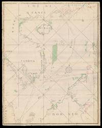
Carte depuis la fin du Detroit de la Sonde jusqu'a la fin D'Etroit de Banca faitte en l'anne 1734 [Singapore Strait] [South China Sea].: Charting a voyage of nearly two thousand nautical miles from the Sunda Strait to Hong Kong
by LE SAGE, P.
- Used
- Signed
- Condition
- Used
- Quantity Available
- 1
- Seller
-
London, United Kingdom
- Item Price
-
NZ$185,092.50NZ$31.91 shipping to USA
Show Details
Description:
[Probably Lorient,: La Compagnie perpétuelle des Indes], , 1734.. 1100 by 680mm. (43.25 by 26.75 inches), each sheet. Three manuscript charts, on two different scales, but adjoining, pen and red and black ink with colour wash, on paper, laid down on blue linen, signed within the title cartouche (lower sheet only) on a paper overlay upper right. A magnificent series of manuscript charts plotting a continuous route, of nearly two thousand nautical miles, for the voyage of Captain Louis Dryas in the French East Indiaman, La Paix, from the northeastern exit of the Sunda Strait to the estuary of the Pearl River in China: "Route du Vaisseau la Compagnie de Indes Paix Capitaine Monsieur Louis Dryas allant en Chine en 1733". Possibly a private commission, perhaps to commemorate one of the earliest voyages undertaken by the La Compagnie perpétuelle des Indes, according to new regulations that came into effect in September of 1733. These clearly defined the use of company vessels according to their…
Read More Item Price
NZ$185,092.50
NZ$31.91
shipping to USA

A New Map of the Island of Barbadoes: First systematic map of the island wherein every Parish, Plantation, Watermill, Windmill and Cattlemill is described with the name of the Present Possessor.
by LEA, Philip; FORD, Richard
- Used
- Condition
- Used
- Quantity Available
- 1
- Seller
-
London, United Kingdom
- Item Price
-
NZ$8,510.00NZ$31.91 shipping to USA
Show Details
Description:
London,: By Phillip Lea at ye Atlas & Hercules in ye Poltry over against ye ould Jury and by John Sellers at his shop on the West side of the Royal Exchange,, [c.1682].. 530 by 610mm. (20.75 by 24 inches).. Hand-coloured engraved map. This very rare map is the earliest systematic survey of Barbados. Produced from the surveys of Richard Ford during the 1670s it shows the already extensive nature of sugar cultivation throughout the island. The map is oriented with north to the right by a large compass rose. Each of the island's eleven parishes, as established in 1645, are located and named. Each land plot and plantation (844) is identified with the proprietor's name and only six small patches of native forest remain uncultivated. The celebrated sugar mills throughout the island are located and shown with icons identified in a key as either windmill, watermill, or cattlemill - all which are employed in the grinding of sugar canes. The map is embellished with small vignettes of local plants such as the…
Read More Item Price
NZ$8,510.00
NZ$31.91
shipping to USA

First Described in Six Plats, 10 Decemr. Ao. Domi 1666, by the Order & Directions of the Right Honourable the Lord Mayor, Aldermen, & Common Councell of the Said City, Iohn Leake, Iohn Iennings, Willm. Marr, Willm.Leybourne, Thomas Street, Richard Shortgrave, Svrveyors. & Reduced into One intire Plat.
by LEAKE, John
- Used
- Condition
- Used
- Quantity Available
- 1
- Seller
-
London, United Kingdom
- Item Price
-
NZ$4,255.00NZ$31.91 shipping to USA
Show Details
Description:
[London,: Engraved by George Vertue for the Society of Antiquaries],, 1723.. 500 by 1200mm (19.75 by 47.25 inches).. Maps,""An Exact Surveigh of the Streets, Lanes and Churches Comprehending within the Ruins of the City of London. London after the Great Fire Engraved plan on two sheets, joined, hand-coloured in outline, a few old tears skilfully repaired. Large and detailed plan of the City of London after the Great Fire. Title on banderole across top. The map overlaps the banderole at top centre. Inset close to the top of the map are seven views of City buildings and streets. On the right is a map of London, Westminster and Southwark showing the burnt area of the City. On a banner below this the lines appearing on the map are explained. Scale-bar at bottom right. The map shows the extent of the Great Fire; the widening of some streets (e.g. Newgate, and Gracechurch Street to London Bridge); the creation of King Street and Queen Street and a Thames embankment; and the canalisation of the Fleet…
Read More Item Price
NZ$4,255.00
NZ$31.91
shipping to USA

... Son of the late Rob.t Legg opposite Bloomsbury Market.
by LEGG, Robert; DARLY, Robert (engraver)
- Used
- Condition
- Used
- Quantity Available
- 1
- Seller
-
London, United Kingdom
- Item Price
-
NZ$4,255.00NZ$31.91 shipping to USA
Show Details
Description:
[London],: at the Sign of ye Leg near Southampton Street in Holborn, [from 1780]. 155 by 205mm. (6 by 8 inches).. Prints,""Robert Legg Upholder, Appraiser & Undertaker A is for Appraiser Engraved trade card. Robert Legg, the elder, had founded the family undertaking business with his wife, Elizabeth, which flourished from 1707-1738, after which it was inherited by his son, Robert Legg, the younger. This later Legg's elaborate trade card, featuring exotic Chinoiserie motifs, was engraved by Matthias Darly of Chandois Street, son of well-known engraver of satirical prints, Matthias/Matthew Darly (c1720-1775), who had worked with Chippendale during the 1750s. BM Heal 125.62
Item Price
NZ$4,255.00
NZ$31.91
shipping to USA

Didn’t find what you’re looking for?
Try adding this search to your want list. Millions of books are added to our site everyday and when we find one that matches your search, we’ll send you an email. Best of all, it’s free.
Add to Want List

Are you a frequent reader or book collector?
Join the Bibliophile's Club and save 10% on every purchase, every day — up to $20 savings per order!

Social Responsibility
Did you know that since 2004, Biblio has used its profits to build 16 public libraries in rural villages of South America?
