Skip to content

Search Results: Authors starting with M from BICKERSTAFF'S BOOKS, MAPS &C.

You searched for:
  • Bookseller inventory: BICKERSTAFF'S BOOKS, MAPS &C. (authors starting with M)
  • Bookseller: BICKERSTAFF'S BOOKS, MAPS &C.
Results 1 - 2 of 2
The History of the District of Maine....Illustrated by a new correct Map of the District.
More Photos

The History of the District of Maine....Illustrated by a new correct Map of the District.

by [Maine.] Sullivan, James.

  • Used
  • Hardcover
Condition
Used - See below
Binding
Hardcover
Quantity Available
1
Seller
Scarborough, Maine, United States
Seller rating:
This seller has earned a 5 of 5 Stars rating from Biblio customers.
Item Price
NZ$3,857.85
NZ$17.15 shipping to USA

Show Details

Description:
This is the first general history of Maine, written in the post-Revolutionary War time period that saw several state histories published, including those by Belknap, Jefferson and Ramsay. Despite its distinctly chilly initial reception and the less than impressive editorial standards, Sullivan's History
is a cornerstone work in any collection of Maine material.
The History
includes as the frontispiece Osgood Carleton's A Map of the District of Maine Drawn from the latest Surveys and other best Authorities by Osgood Carleton. The map, measuring 20 5/16 x 16 3/8", includes an inset titled A Map of those parts of the Country most famous for being harassed [sic] by the Indians. Carleton's map was the most detailed done of Maine to that time.
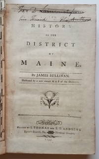
At the head of the title page is an inscription which has been lined out: "For D. Laincourt[?] from his Friend, the Author."
References: Evans: 29589. Howes, USiana: S-1122. Sabin: 93499. Williamson, A Bibliography of the State of Maine: 9608. Thompson:… Read More
Item Price
NZ$3,857.85
NZ$17.15 shipping to USA
[The Harbours and Rivers between Portland Point and Stage Island.]
More Photos

[The Harbours and Rivers between Portland Point and Stage Island.]

by [Maine: Casco Bay.] Des Barres, Joseph Frederick Wallet.

  • Used
Condition
Used
Quantity Available
1
Seller
Scarborough, Maine, United States
Seller rating:
This seller has earned a 5 of 5 Stars rating from Biblio customers.
Item Price
NZ$13,631.07
NZ$17.15 shipping to USA

Show Details

Description:
Striking Casco Bay Chart from the Atlantic Neptune, 1776This is an exceptional chart of the coast of Maine between Cape Elizabeth and Popham from the early Revolutionary War period. It is from Des Barres' monumental Atlantic Neptune, a sea atlas published by the British Admiralty during the last quarter of the 18th century. The Atlantic Neptune has been called "the most splendid collection of charts, plans, and views, ever published." The present chart includes all of Casco Bay (naming the larger islands) and extends east to include Seguin ("Segevin Island") and Georgetown Islands. Among the numerous geographic features named are Great Jebieg (Chebeague), Merrymeeting Bay, Segadahock River, Arrowsick Island and Halfway Road (i.e., Rock). Roads are shown on the chart, as are individual buildings. The chart is dated July___ 1776 (i.e., with a prominent space after the month as if a date were going to be inserted). There is no type-stamped "15" at the upper right as called for in some copies of… Read More
Item Price
NZ$13,631.07
NZ$17.15 shipping to USA
Add to Want List

Didn’t find what you’re looking for?

Try adding this search to your want list. Millions of books are added to our site everyday and when we find one that matches your search, we’ll send you an email. Best of all, it’s free.

Add to Want List
Book lovers can save on books by joining our Bibliophiles club

Are you a frequent reader or book collector?

Join the Bibliophile's Club and save 10% on every purchase, every day — up to $20 savings per order!

Biblio is a socially responsible company

Social Responsibility

Did you know that since 2004, Biblio has used its profits to build 16 public libraries in rural villages of South America?