
Click for full-size.
Carte Chorographique Des Pays-Bas Autrichiens
by Ferraris, Josef Johann, Graf von
- Used
- Condition
- See description
- Seller
-
Narberth, Pennsylvania, United States
Payment Methods Accepted
About This Item
[Mechelen (Malines): Joseph Dochez], 1778. HOUSED IN A CONTEMPORARY "BLOOK" - A MOTTLED CALF-COVERED WOODEN BOX MADE TO LOOK LIKE FIVE UNIFORMLY BOUND QUARTO VOLUMES (worn); each spine has one black and five gilt-lettered red calf labels; the top of the box slides off horizontally.
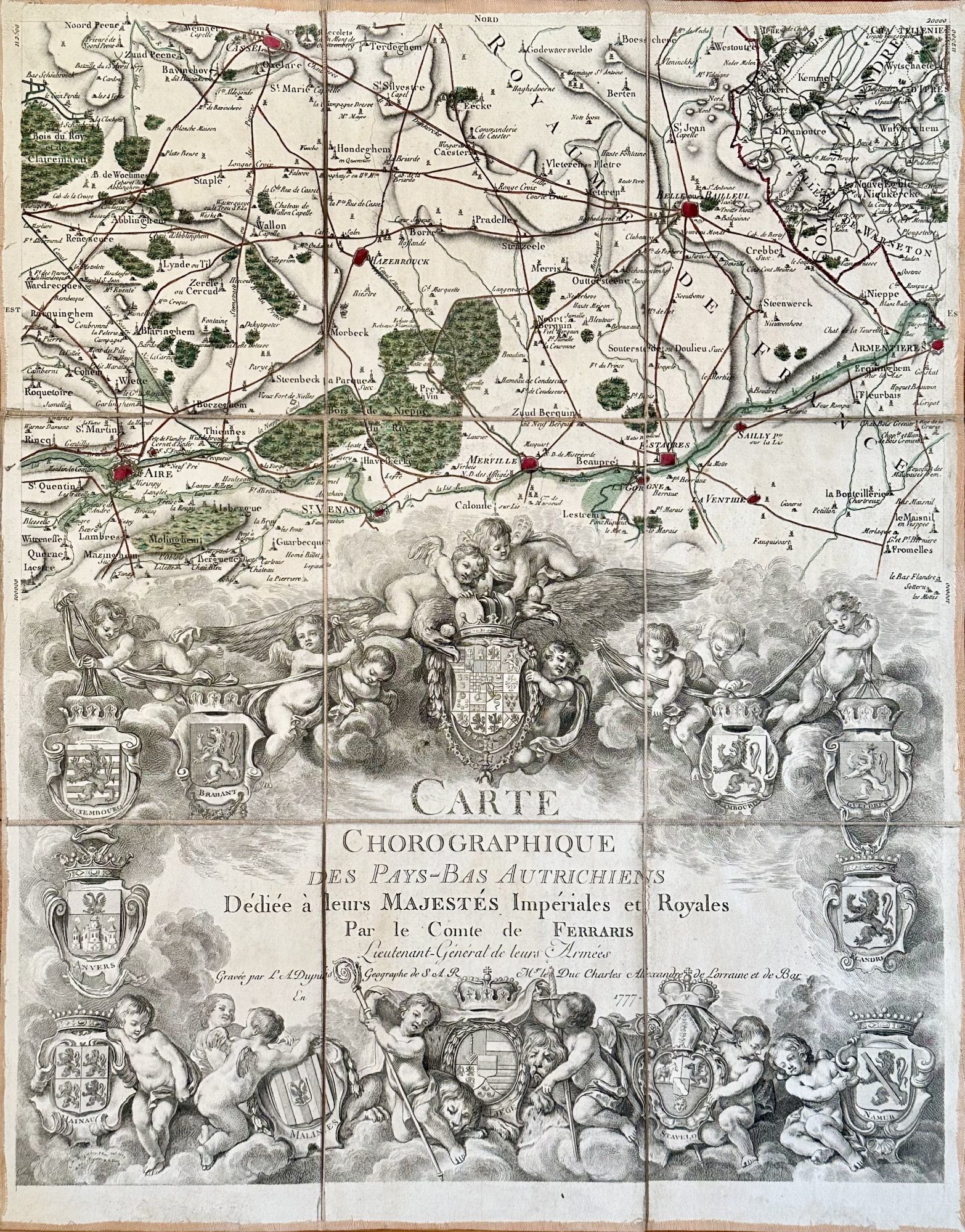
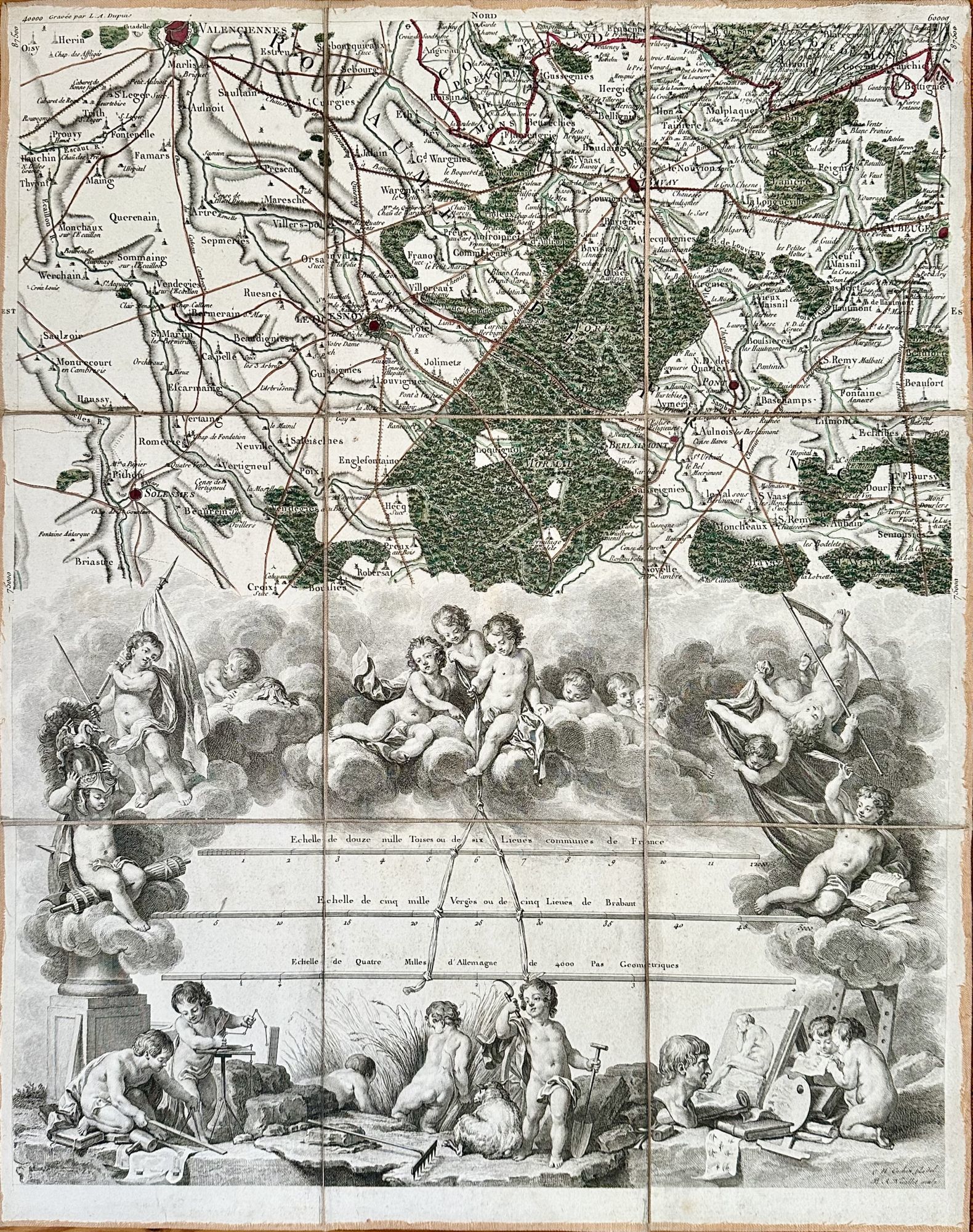
Ad I-II: COMPLETE and complemented by its fugitive illustrated Prospectus. This is the first printed large-scale topographic map of Belgium and Luxembourg, produced "in response to the shortage of accurate and reliable maps experienced by the military forces during the Seven Years' War" (Vervust).
Closely associated with the Viennese Court and a skilled artillerist, Ferraris directed the survey from 1771 to 1775. "Its execution was headed by three members of his staff...who led as many as 178 members of the artillery corps...using only simple plane tables and surveyor's chains" (Bracke, History). Ferraris produced three 275-sheet manuscript maps - one for the Austrian Emperor, one for the Duke of Lorraine, and one for government archives. The sale of this engraved version was to subsidize the project.
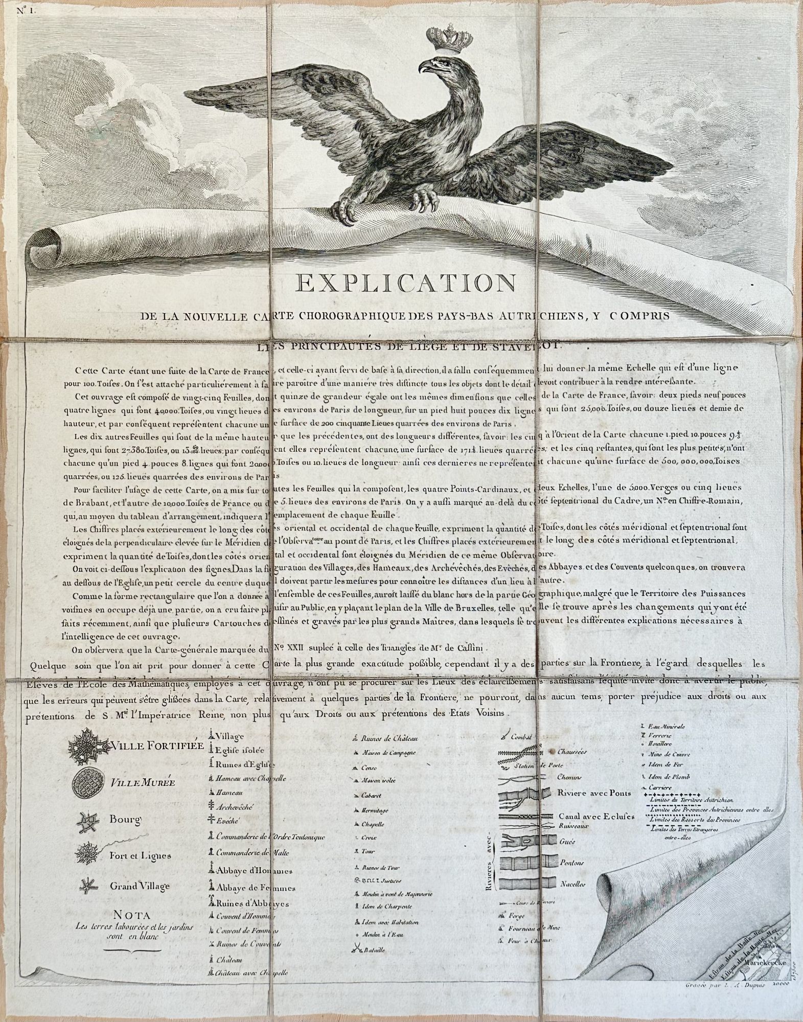
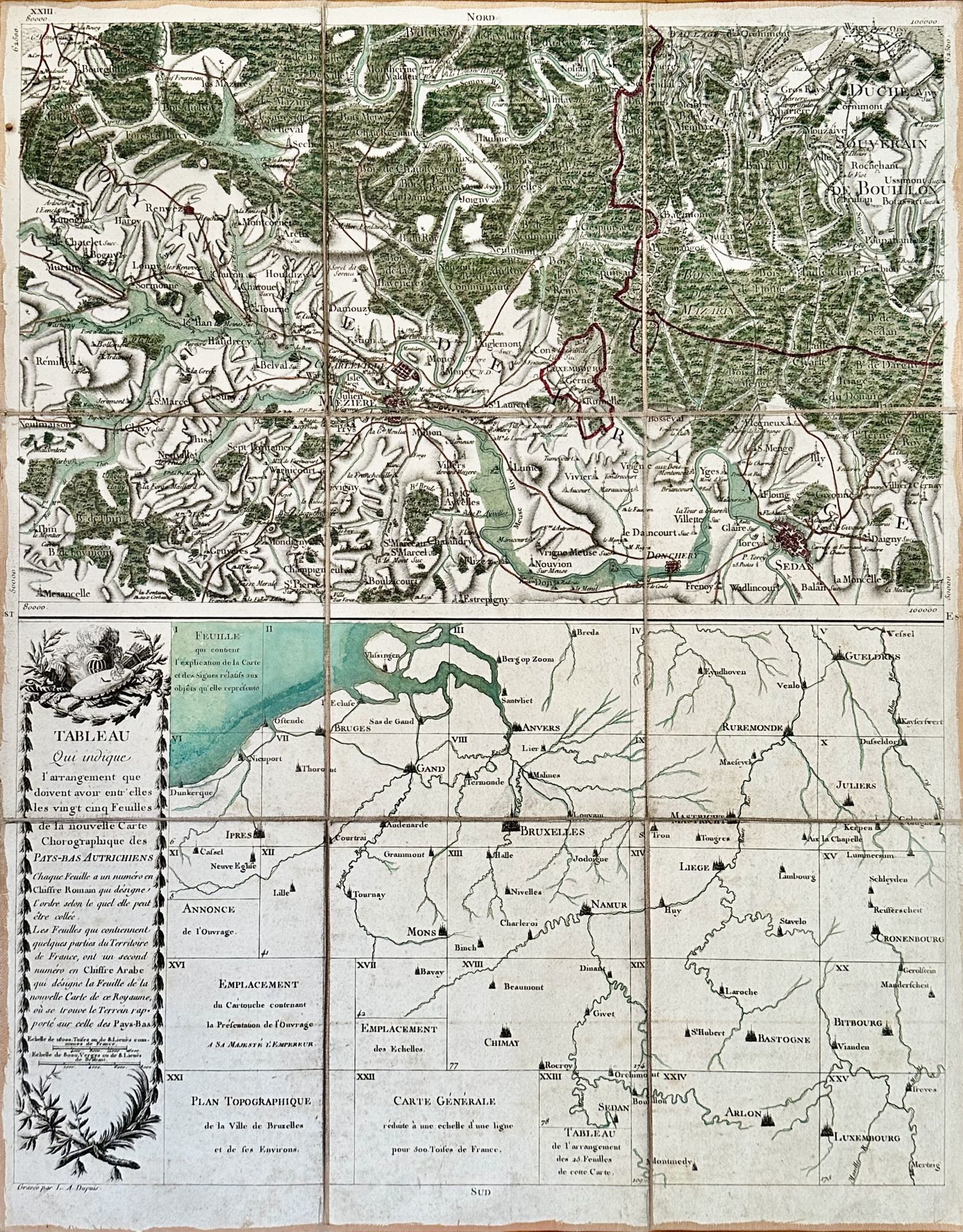
FERRARIS CREATED "THE EARLIEST CHARACTERISTIC SHEET TO A TOPOGRAPHICAL MAP" (Wallis & Robinson), illustrating and explaining the sixty-two symbols used here (sheet 1). The set also contains a large engraving of Ferraris presenting a map to the emperor (sheet 16), a bird's-eye view of Bruxelles (sheet 22) and assembly instructions (sheet 23).
This set identifies two of the vendors of this monumental print. The Prospectus directs buyers to the Covens' shop in Amsterdam. The present copy of the Carte was purchased from Parisian map dealer Vignon and bears his circular etched label on four of the linen mounts.
In good condition (some linen frayed at the folds; top and bottom of the wooden box fragile); the linen mount of each map has been signed in a contemporary hand Sorberio - ?François-André de Sorberio (or de Sorber, b. 1703), the Navarre parliamentarian.
¶Vervust, "Count de Ferraris's Maps of the Austrian Netherlands (1770s)" in Imago Mundi 68 (2016) 164-82; Bracke, "Ferraris Survey of the Austrian Netherlands" in The History of Cartography 4: Cartography in the European Enlightenment edd. Edney & Pedley 403-406 & figg. 238 & 749; Wallis & Robinson, Cartographical Innovations 248; De grote Atlas van Ferraris ed. Bracke passim; Tooley's Dictionary of Mapmakers. Revised Ed. II: 62-3.
Reviews
(Log in or Create an Account first!)
Details
- Seller
- Bruce McKittrick Rare Books
 (US)
(US)
- Seller's Inventory #
- 12006
- Title
- Carte Chorographique Des Pays-Bas Autrichiens
- Author
- Ferraris, Josef Johann, Graf von
- Format/Binding
- HOUSED IN A CONTEMPORARY "BLOOK" - A MOTTLED CALF-COVERED WOODEN BOX MADE TO LOOK LIKE FIVE UNIFORMLY BOUND QUARTO VOLUMES (worn
- Book Condition
- Used
- Quantity Available
- 1
- Publisher
- Joseph Dochez]
- Place of Publication
- [Mechelen (Malines)
- Date Published
- 1778
Terms of Sale
Bruce McKittrick Rare Books
All books are sent on approval and may be returned for any reason within ten days.
We ask that customers not known to us supply trade references or remit pro forma. We accept checks and wire transfers as well as Visa and MasterCard. All books offered are subject to prior sale.
Postage and insurance are gratis. For domestic orders we use UPS. International orders are shipped by USPS Registered Air Mail or Federal Express, unless otherwise instructed.
About the Seller
Bruce McKittrick Rare Books
Biblio member since 2020
Narberth, Pennsylvania
About Bruce McKittrick Rare Books
Since 1979 we have specialized in pre-1830 European book and manuscripts, with an emphasis on early printing, illustration, copy specific characteristics, bindings, and condition.
Glossary
Some terminology that may be used in this description includes:
- Spine
- The outer portion of a book which covers the actual binding. The spine usually faces outward when a book is placed on a shelf....
- Quarto
- The term quarto is used to describe a page or book size. A printed sheet is made with four pages of text on each side, and the...
- Calf
- Calf or calf hide is a common form of leather binding. Calf binding is naturally a light brown but there are ways to treat the...

Signed Books
Why settle for an ordinary copy of your favorite book when you could have an autographed copy? Find signed books here.

Collecting Nebula Award Winners of the 1980s
The Nebula Award has been awarded to stories in the Science Fiction and Fantasy genre every year since 1966. Learn about the winners of the 1980s!