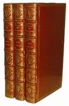
A Map of the County of Essex: Essex - The finest large-scale map of Essex From an Actual Survey made in MDCCLXXII, MDCCLXXIII and MDCCLXXIV by John Chapman and Peter Andre.
by CHAPMAN, John & ANDRE, Peter
- Used
- Hardcover
- Condition
- See description
- Seller
-
London, United Kingdom
Payment Methods Accepted
About This Item
London,: Chalk Meggy and Chalk,, [1831].. Folio (440 by 390 mm), index map, and 25 double-page engraved map sheets, all with fine original hand-colour, some minor offsetting, modern half calf over marbled paper boards. Chapman and André's survey of Essex was one of the most celebrated of the nineteenth century large-scale maps with a wealth of detail matched by extraordinary accuracy, even when checked against large-scale contemporary estate maps. Minor roads were depicted on a map of the county for the first time with bridges, milestones and turnpike gates, whilst on the long coastline every creek, wharf, quay, ferry, duck decoy and cliff is shown. The countryside is extensively delineated with hills, woods, parks and heaths clearly depicted and often named. Except in the towns and villages, nearly every house and cottage is marked, whilst the principal seats and their owners, and most of the manor houses, and farm houses are named. There are complete sheets devoted to the vignette title (an Essex fulling mill with two cloth beaters and Harwich and Dovercourt churches in the background), and a list of 240 subscribers. Further sheets include a general map of the county to serve as a key map, an outline of Harwich Harbour and a plan of Colchester on a scale of 168 yards to the inch including information about the town such as fairs and market days. It is unlikely that more than 300 copies of this edition were sold, though there was a second smaller edition issued in 1785. The twenty-one sheets covering the survey of the county, together with the rest of the atlas, are all fully coloured by a contemporary hand to make it one of the most competent and attractive of the large-scale surveys.
Reviews
(Log in or Create an Account first!)
Details
- Seller
- Daniel Crouch Rare Books Ltd
(GB)
- Seller's Inventory #
- 12234
- Title
- A Map of the County of Essex
- Author
- CHAPMAN, John & ANDRE, Peter
- Book Condition
- Used
- Binding
- Hardcover
- Publisher
- Chalk Meggy and Chalk,
- Place of Publication
- London,
- Date Published
- [1831].
- Keywords
- Essex, Large scale, Antique Map, Rare Map
- Product_type
- Maps
Terms of Sale
Daniel Crouch Rare Books Ltd
Any item may be returned if you are not happy with it providing we are notified within 7 days of your receiving it. This does not affect any statutory rights you may have under UK or EU law for returning the item outside this period. All we ask is that you return the item(s) by the same or similar method to that in which they were sent to you. Your postage costs and any payment already received will be refunded immediately on our receipt of the items in the same condition as you received them.
About the Seller
Daniel Crouch Rare Books Ltd
Biblio member since 2018
London
About Daniel Crouch Rare Books Ltd
Daniel Crouch Rare Books is specialist dealer in antique atlases, maps, plans, sea charts and voyages dating from the fifteenth to the nineteenth centuries. Our carefully selected stock also includes a number of fine prints and globes, and a selection of cartographic reference books.Our particular passions include rare atlases, wall maps, and separately published maps and charts. We strive to acquire unusual and quirky maps that are in fine condition. We are members of the following trade associations: The Antiquarian Bookseller's Association (ABA); The British Antique Dealers' Association (BADA); Confédération Internationale des Négociantes en Oeuvres d'Art (CINOA); The International League of Antiquarian Booksellers (ILAB); The Society of London Art Dealers (SLAD); and The European Fine Art Foundation (TEFAF). Daniel and Nick are also both members of The Company of Art Scholars, Dealers, and Collectors.
Glossary
Some terminology that may be used in this description includes:
- Marbled Paper
- Decorative colored paper that imitates marble with a veined, mottled, or swirling pattern. Commonly used as the end papers or...
- Cloth
- "Cloth-bound" generally refers to a hardcover book with cloth covering the outside of the book covers. The cloth is stretched...
- Folio
- A folio usually indicates a large book size of 15" in height or larger when used in the context of a book description. Further,...
- Vignette
- A decorative design or illustration placed at the beginning or end of a ...
- Fine
- A book in fine condition exhibits no flaws. A fine condition book closely approaches As New condition, but may lack the...
- Calf
- Calf or calf hide is a common form of leather binding. Calf binding is naturally a light brown but there are ways to treat the...


