Description:
Independently published, 2020-12-07. Paperback. Used: Good.
Nautical Chart No. 2317 Barents Sea, Omgang to Mys Nemetskiy including Varangerfjorden by Admiralty - 2004
by Admiralty

Nautical Chart No. 2317 Barents Sea, Omgang to Mys Nemetskiy including Varangerfjorden
by Admiralty
- Used
- Paperback
Admiralty, 2004. Revised Edition. Softcover. Very Good Condition/No Dust Jacket. Crisp and clean colour chart with single horizontal fold. Very minor wear to edges. Nautical Chart No. 2317 Barents Sea, Omgang to Mys Nemetskiy including Varangerfjorden. 2004 edition of 1996 publication. Scale 1:200,000. Area Covered: Norway (part), Russia (part), Berlevag, Vadso, Bugoyfjord, Skogeroya, Poluostrov Sredniy, Vardo, Hamninberg, Kirkenes, Linakhamari. Barents Sea (part), Osthavet, Tanafjorden, Varangerfjorden, Kongsfjorden, Persfjorden. Size: 104x72cm. Single sheet map/chart which is suitable for framing and will be shipped rolled and in a cardboard tube. Quantity Available: 1. Shipped Weight: under 1 kg. Pictures of this item not already displayed here available upon request. Inventory No: 45517074011..
-
Bookseller
Bailgate Books Ltd
 (GB)
(GB)
- Format/Binding Softcover
- Book Condition Used - Very Good Condition
- Jacket Condition No Dust Jacket
- Quantity Available 1
- Edition Revised Edition
- Binding Paperback
- Publisher Admiralty
- Date Published 2004
- Keywords BZDB4 NOISBN naval, naval history, maritime, ships, boats; Maps; Scandinavia. Nautical Chart No 2317 Barents Sea Omgang to Mys Nemetskiy including Varangerfjorden Admiralty

Jesus is Christmas
by Irick, Mr. Admiral
- Used
- Paperback
- Condition
- Used: Good
- Binding
- Paperback
- Quantity Available
- 1
- Seller
-
HOUSTON, Texas, United States
- Item Price
-
NZ$7.87
Show Details
Item Price
NZ$7.87
Jesus is Christmas
by Irick, Mr. Admiral
- Used
- Paperback
- Condition
- Used:Good
- Binding
- Paperback
- Quantity Available
- 1
- Seller
-
HOUSTON, Texas, United States
- Item Price
-
NZ$7.87
Show Details
Description:
Independently published, 2020-12-07. Paperback. Used:Good.
Item Price
NZ$7.87
Stock Photo: Cover May Be Different
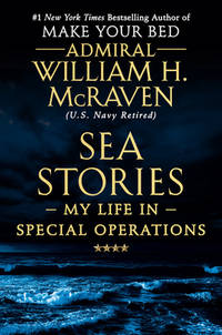
Sea Stories: My Life in Special Operations
by McRaven, Admiral William H
- Used
- Condition
- UsedGood
- ISBN 10 / ISBN 13
- 9781538729748 / 1538729741
- Quantity Available
- 1
- Seller
-
Imperial, Missouri, United States
- Item Price
-
NZ$8.21
Show Details
Description:
UsedGood. The item shows wear from consistent use, but it remains in good condition and works perfectly. All pages and cover are intact (including the dust cover, if applicable). Spine may show signs of wear. Pages may include limited notes and highlighting. May NOT include discs, access code or other supplemental materials.
Item Price
NZ$8.21

Stock Photo: Cover May Be Different
The Spinal Cord Injured Patient : Comprehensive Management
by Lee, Rachel, Cochrane, Admiral Lord, Shaw
- Used
- Condition
- Used - Good
- ISBN 10 / ISBN 13
- 9780721656991 / 0721656994
- Quantity Available
- 1
- Seller
-
Mishawaka, Indiana, United States
- Item Price
-
NZ$8.46
Show Details
Description:
Elsevier - Health Sciences Division. Used - Good. Used book that is in clean, average condition without any missing pages.
Item Price
NZ$8.46

Stock Photo: Cover May Be Different
Character in Action: The U.S. Coast Guard on Leadership
by Phillips, Donald T.,Loy, Adm. James M
- Used
- good
- Paperback
- Condition
- Used - Good
- Binding
- Paperback
- ISBN 10 / ISBN 13
- 9781591146735 / 1591146739
- Quantity Available
- 1
- Seller
-
HILLSIDE, New Jersey, United States
- Item Price
-
NZ$3.59
Show Details
Description:
Naval Institute Press, 11/15/2013 12:00:01. paperback. Good. 0.7000 in x 8.8000 in x 5.9000 in. Crease on cover*
Item Price
NZ$3.59

Stock Photo: Cover May Be Different
Reading, Understanding, and Applying Nursing Research
by Fain PhD RN BC-ADM FADCES FAAN, James A
- Used
- Acceptable
- Paperback
- Condition
- Used - Acceptable
- Binding
- Paperback
- ISBN 10 / ISBN 13
- 9780803660410 / 0803660413
- Quantity Available
- 1
- Seller
-
Memphis, Tennessee, United States
- Item Price
-
NZ$8.76
Show Details
Description:
F A Davis Co, 2017-02-20. Paperback. Acceptable. 6x0x9.
Item Price
NZ$8.76
Stock Photo: Cover May Be Different
Reading, Understanding, and Applying Nursing Research
by Fain PhD RN BC-ADM FADCES FAAN, James A
- Used
- Acceptable
- Paperback
- Condition
- Used - Acceptable
- Binding
- Paperback
- ISBN 10 / ISBN 13
- 9780803660410 / 0803660413
- Quantity Available
- 1
- Seller
-
Houston, Texas, United States
- Item Price
-
NZ$8.87
Show Details
Description:
F A Davis Co, 2017-02-20. paperback. Acceptable. 6x0x9.
Item Price
NZ$8.87
Stock Photo: Cover May Be Different
Reading, Understanding, and Applying Nursing Research
by Fain PhD RN BC-ADM FADCES FAAN, James A
- Used
- Paperback
- Condition
- Used - Good condition
- Edition
- Fifth
- Binding
- Paperback
- ISBN 10 / ISBN 13
- 9780803660410 / 0803660413
- Quantity Available
- 1
- Seller
-
Signal Mountain, Tennessee, United States
- Item Price
-
NZ$2.27
Show Details
Description:
F A Davis Co, 2017-02-19. Fifth. paperback. Good condition. 6x0x9. good condition,fast ship
Item Price
NZ$2.27

Stock Photo: Cover May Be Different
Sailing True North: Ten Admirals and the Voyage of Character
by Stavridis USN, Admiral James
- Used
- Condition
- UsedGood
- ISBN 10 / ISBN 13
- 9780525559955 / 0525559957
- Quantity Available
- 1
- Seller
-
Lynden, Washington, United States
- Item Price
-
NZ$9.04
Show Details
Description:
UsedGood. Book is in good condition and may contain underlining or highlighting and minimal wear. The book can also include library labels. May not contain miscellaneous items (toys, dvds, etc). We offer 100% money back guarantee and fast customer support.
Item Price
NZ$9.04
Stock Photo: Cover May Be Different
Sailing True North: Ten Admirals and the Voyage of Character
by Stavridis USN, Admiral James
- Used
- very good
- Paperback
- Condition
- Used - Very Good
- Binding
- Paperback
- ISBN 10 / ISBN 13
- 9780525559955 / 0525559957
- Quantity Available
- 1
- Seller
-
Chicago, Illinois, United States
- Item Price
-
NZ$3.96
Show Details
Description:
Penguin Books, 10/13/2020 12:00:01. paperback. Very Good. 0.9400 in x 8.3500 in x 5.4300 in.
Item Price
NZ$3.96
