Description:
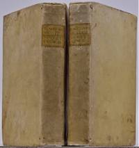
London: Thomas Newberry, 1657. 1st Edition . Hardcover. Good/No Jacket. 1657 FIRST EDITION, no illustrations, no maps, 278mm tall (covers), 272mm tall (pages). Full title: A Geographical Description Of All The Countries In The Known World. As Also Of the greatest and famousest Cities and Fabricks which have been, or are now remaining: Together with The greatest Rivers, the Strangest Fountains, the various Minerals, Stones, Trees, Hearbs, Plants, Fruits, Gums, &c. which are to bee found in every Country. Unto which is added, a Description of The rarest Beasts, Fowls, Birds, Fishes, and Serpents which are least known amongst us. Collected out of the most approved Authors, and from such as were eye-witnesses of most of the things contained herein. Vellum boards with calf title patch on spine lettered in gilt. Title page + 225 pages + 6 unnumbered pages of index + 7 pages of manuscript index. Soiled covers, some flaking on rear cover, solid binding, occasional page soiling but nothing major, wrinkle to…
Read More Novissima et Accuratissima Romae Veteris et Novae Tabula Topgraphica Delineatore Ionne Baptista Falda by Halma and van der Aa - [1695]
by Halma and van der Aa
![Novissima et Accuratissima Romae Veteris et Novae Tabula Topgraphica Delineatore Ionne Baptista Falda by Halma and van der Aa - [1695]](https://d3525k1ryd2155.cloudfront.net/h/490/263/1456263490.0.m.jpg)
Novissima et Accuratissima Romae Veteris et Novae Tabula Topgraphica Delineatore Ionne Baptista Falda
by Halma and van der Aa
- Used
Halma and van der Aa
Novissima et Accuratissima Romae Veteris et Novae Tabula Topographica Delineatore Ionne Baptista Falda.
After the drawings and map by the architect Giovanni Battista Falda da Valdugga. Originally published in 1667. It contains an amazing amount of detail consisting of: the Coliseum, Pantheon, St. Peter's Basilica, many streets, bridges, various piazzas, and several allegorical scenes including one of St. Peter. The 473 locations are described by the numerical keys on each side of the map. A very good copy, at one time folded over and stubbed into a large folio, and now expertly removed. A scarce map (WorldCat finds only one copy) published [1695] in Leiden.
-
Bookseller
Rachel Smith Books
 (US)
(US)
- Book Condition Used - Good+
- Quantity Available 1
- Publisher Halma and van der Aa.
- Place of Publication Leiden
- Date Published [1695]
- Size 19.25 x 25”
- Keywords Rome maps, architecture of Rome, Italian history
- Size 19.25 x 25”
![A Geographicall [sic. Geographical ] Description Of All The Countries In The Known World. RARE...](https://d3525k1ryd2155.cloudfront.net/h/705/080/1090080705.0.m.jpg)
More Photos
A Geographicall [sic. Geographical ] Description Of All The Countries In The Known World. RARE 1657 geography
by Clarke, Samuel
- Used
- good
- Hardcover
- first
- Condition
- Used - Good
- Jacket Condition
- No Jacket
- Edition
- 1st Edition
- Binding
- Hardcover
- Quantity Available
- 1
- Seller
-
Portland, Oregon, United States
- Item Price
-
NZ$1,439.90
Show Details
Item Price
NZ$1,439.90

More Photos
Méthode Pour Etudier L'Histoire Avec Un Catalogue des principaux Historiens
by DUFRESNOY, Nicolas Lenglet
- Used
- near fine
- Hardcover
- Condition
- Used - Near Fine
- Binding
- Hardcover
- Quantity Available
- 1
- Seller
-
COLUMBIA, Missouri, United States
- Item Price
-
NZ$1,270.50
Show Details
Description:
1737 Fresnoy History & Geography MAPS Ancient Greece Rome Egypt Italy 5v SETNicolas du Fresnoy was an 18th-century French scholar known for his vast portfolio of works on philosophy, history, and geography. One of his most important works was his 'Methods of Studying History' – a thorough and detailed collection of articles on ancient kingdoms, rulers and emperors, and history of social classes from the Bible times through the 18th-century. Fresnoy covers ancient Egypt, early French empires, Greek and Romans, and much, much more.
It even includes sections devoted to the history of the church and the influence of the church on the history of Europe. Note the inclusion of impressive, folding maps in this five-volume 1737 edition.
Item number: #14566
Price: $750
DUFRESNOY, Nicolas Lenglet
Méthode Pour Etudier L'Histoire Avec Un Catalogue des principaux Historiens
Amsterdam: Aux Depens De La Compagnie, 1737.
Details:
·
Collation: Complete with all pages; 5 volumes
o
Vol. I – [4],… Read More
Item Price
NZ$1,270.50

More Photos
Country Map of Counties Kunigōri zenzu 国郡全図(くにごうりぜんしゅ
by ICHIKAWA, Toukei
- Used
- near fine
- first
- Condition
- Used - Near Fine
- Edition
- First
- Quantity Available
- 1
- Seller
-
COLUMBIA, Missouri, United States
- Item Price
-
NZ$1,609.30
Show Details
Description:
1837 Japanese ATLAS MAPS Hand Painted COLOR Illustrated Japan Kunigori ZenzuAn interesting 19th century Edo woodblock-print of 'Country Maps of Counties.' This is a rare collection of hand-colored illustrated maps is an Atlas from different counties in Japan from Kinai to Tokaido and Tosan-do. This rare 1837 first edition has 34 double pages of illustrations throughout!
Item number: #15945
Price: $950
市川 東谿
ICHIKAWA, Toukei
Country Map of Counties (Kunigōri zenzu) 国郡全図(くにごうりぜんしゅ)
(Honshirogane) Edo: Nagakaya Toshiro, Tenpo 8 [1837]. First Edition.
Details:
·
Collation: Complete with all pages
o
Illustrated throughout
·
Language: Japanese
·
Binding: Softcover; tight & secure
·
Size: ~11in X 7.75in (28cm x 19.5cm)
·
Very rare and desirable with auctions records and price comparisons at $2500
Our Guarantee:
Very Fast. Very Safe. Free Shipping Worldwide.
Customer satisfaction is our priority! Notify us with 7 days of receiving,… Read More
Item Price
NZ$1,609.30

More Photos
Atlas of Indiana County, Pennsylvania
by BEERS, D.G.
- Used
- near fine
- Hardcover
- Condition
- Used - Near Fine
- Binding
- Hardcover
- Quantity Available
- 1
- Seller
-
COLUMBIA, Missouri, United States
- Item Price
-
NZ$1,270.50
Show Details
Description:
1871 HUGE ATLAS Indiana County Pennsylvania Pittsburgh Color City MAPS DG BeersA rare 19th-century atlas of Indiana County, Pennsylvania. Collected by D.G. Beers, this atlas features 40 colored maps of the towns in west-central Pennsylvania. Beers atlases are considered to highly accurate and very popular, even to today.
Item number: #15253
Price: $750
BEERS, D.G.
Atlas of Indiana County, Pennsylvania
Philadelphia : D.G. Beers, 1871.
Details:
· Collation: Complete with all pages
o 40 maps
· Provenance: Handwritten
o James P. George
o J. Cal. George
o David George
· Language: English
· Binding: Leather; tight and secure
·
Size: ~16in X 13.25in (40.5cm x 33.5cm)
Our Guarantee:
Very Fast. Very Safe. Free Shipping Worldwide.
Customer satisfaction is our priority! Notify us with 7 days of receiving, and we will offer a full refund without reservation!
15253Photos available upon request.
Item Price
NZ$1,270.50

More Photos
Illustrated historical atlas of the Counties of Northumberland and Durham, Ont.
by BELDEN and Co.
- Used
- near fine
- Hardcover
- first
- Condition
- Used - Near Fine
- Edition
- First
- Binding
- Hardcover
- Quantity Available
- 1
- Seller
-
COLUMBIA, Missouri, United States
- Item Price
-
NZ$1,609.30
Show Details
Description:
1878 1ed CANADA Atlas Illustrated MAPS Northumberland Durham Ontario TorontoBelden's famous 'Illustrated Historical Atlas' is a rare, late 19th-century Canadian atlas filled with maps, city views, and portraits. This particular atlas cover the country sides of Northumberland and Durham Counties in Ontario, Canada. This 1878 first edition was published in Toronto and contains all of the expected color maps and illustrations.
Item number: #17516
Price: $950
BELDEN and Co.
Illustrated historical atlas of the Counties of Northumberland and Durham, Ont.
Toronto : H. Belden & Co., 1878. First edition.
Details:
·
Collation: Complete with all pages
o [4], x, 121
·
Provenance: Handwritten – Sam G. M. Nesbitt
o
Samuel Greerson Murray Nesbitt (1859–1938) was an apple exporter and political figure in Ontario. Nesbitt was president of the Canadian Canning Company and served eight years as reeve of Brighton. In 1915, Nesbitt donated land and funds towards the construction of the Brighton… Read More
Item Price
NZ$1,609.30
![The Countye Palatine of Chester with that most Ancient Citie described. [Cheshire], John Speed,...](https://d3525k1ryd2155.cloudfront.net/h/266/067/50067266.0.m.jpg)
More Photos
The Countye Palatine of Chester with that most Ancient Citie described. [Cheshire], John Speed, [1676]
by John Speed
- Used
- very good
- Condition
- Used - Very Good
- Edition
- Basset & Chiswell, [London, 1610-1676].
- Quantity Available
- 1
- Seller
-
Plymouth, Devon, United Kingdom
- Item Price
-
NZ$1,593.07
Show Details
Description:
Speed, John : Cheshire. The Countye Palatine of Chester with that most Ancient Citie described. Basset & Chiswell, [London, 1610-1676]. Size approx 510mm x 380mm ( 20 x 15 inches). Early hand coloured double page copper engraved map. From Speed's "The Theatre of the Empire of Great Britain" with English text on verso and a description of the county and a gazetteer. Inset town plan of Chester. Seven coast of arms of "The Armes of the Earles of Chester since the Norman Conquest". Four decorative cartouches. Speed has used William Smith's revisions of Saxton and the Braun & Hogenberg plan of Chester. Good margins. Very small hole (approx 2mm or 1/10in) in the decorative border, otherwise fine condition. A strong dark impression of this famous decorative county map of Cheshire.
Item Price
NZ$1,593.07

More Photos
Hudson River and the Hudson River Railroad: with a complete map and wood cut views of the principal objects of interest upon the line
by HUDSON RIVER RAILROAD
- Used
- Condition
- Used - Wrappers chipped at edges, professionally rebacked, some unobtrusive offsetting on map
- Binding
- Unknown
- Quantity Available
- 1
- Seller
-
Ardsley, New York, United States
- Item Price
-
NZ$1,694.00
Show Details
Description:
New York: Wm. C. Locke & Co, 1851. Wrappers chipped at edges, professionally rebacked, some unobtrusive offsetting on map. 8vo. 50 pages. Large folding map on three joined sheets (21 x 1788 cm; 8.25 x 61.75 inches). 11 woodblock illustrations in text (and with 2 more not recorded in the index but always present). Original printed wrappers with woodblock vignette. SCARCE Hudson River Railroad travel guide published the first year in which the full line was completed. It covers points of interest along the route, with woodblocks illustrating the text. Topics include: the history of the Hudson River, the history of the construction of the Hudson River Railroad, and the cities, towns and villages along the Hudson, from New York City all the way to Troy. Concerning the West Point Foundry at Cold Spring, the guide states: "the iron foundry [was] established here by Gouverneur Kemble. The works are situated about a mile west of the village, upon a small stream which tumbles rapidly down the mountains,…
Read More Item Price
NZ$1,694.00
More Photos
De Situ Orbis Libri III cum notis integris Hermolai Barbari, Petri Joannis Olivarii, Fredenandi Nonii Pintiani, Petri Ciacconii, Andreae Schotti, Isaaci Vossii, et Jacobi Gronovii. Accedunt Petri Joannis Nunnesii. et Jacobi Perizonii.cur. Abrahamo Gronovi
by Pomponii Melae
- Used
- very good
- Hardcover
- Condition
- Used - Very Good
- Jacket Condition
- No Jacket, As Issued
- Edition
- Editio Altera ( Second Edition)
- Binding
- Hardcover
- Quantity Available
- 1
- Seller
-
Bloomington, Indiana, United States
- Item Price
-
NZ$1,439.90
Show Details
Description:
Lugduni Batavorum (London): Samuelem Luchtmans et Fil, 1748. Two volumes in contemporary full vellum, Illustrated with allegorical frontispiece engraving and folding engraved map of the known earth in classical times, with numerous copperplate engravings in the text. Title page of V. 2 reads: ..." Pars altera exhibens animadversiones Isaaci Vossii, Jacobi Perizonii, et Abrahami Gronovii, ac dedicationes & praefationes virorum doctorum, atque vitam Fredenandi Nonii Pintiani ab Andrea Schotto descriptam, & quatuor indices ..." (20), 546, (4), 547-1081, (55) pp. The only ancient treatise on geography in classical Latin, written roughly 43 or 44 CE, and remaining in use until around 1500. Very Good. both volumes moderately toned, vellum soiled, map and frontispiece engraving are Fine, small holes top corner first 6 pages Vol. 1 and top corner front end page Vol. 2. A quite handsome and well bound copy of this SCARCE edition in contemporary vellum binding. . Editio Altera (…
Read More Item Price
NZ$1,439.90

More Photos
Acadian Geology: an Account of the Geological Structure and Mineral Resources of Nova Scotia, and Portions of the Neighobouring Provinces of British America.
by Dawson, John William (Sir)
- Used
- Hardcover
- first
- Condition
- Used - Very Good Minus
- Jacket Condition
- No Jacket, As Issued
- Edition
- First Edition
- Binding
- Hardcover
- Quantity Available
- 1
- Seller
-
Bloomington, Indiana, United States
- Item Price
-
NZ$1,439.90
Show Details
Description:
Edinburgh: Oliver and Bord, 1855. RARE in the 1855 First Edition, last seen at auction in 1969 (RBH). Original green embossed cloth with gilt floral arrangement front cover and gilt lettering back, large fold-out color map at rear. Very Good Minus, tears to cloth at head of spine, front hinge opened yet holding nicely, map at rear complete and present, but most of map separated from book, with a 2" chip separated but present. Sir John William Dawson, (1820-1899) ws an important Canadian professor of geology and principal of McGill University for 38 years. He was a Canadian pioneer in the field.of the microscopic studies of fossils, the first British North American trained to be an exploration geologist, and worked in Canada with Charles Lyell, the father of modern geology. . First Edition. Embossed Cloth. Very Good Minus/No Jacket, As Issued. 8vo - over 7¾" - 9¾" tall.
Item Price
NZ$1,439.90

More Photos
Traité de la géographie moderne
by GIBRAT, Jean Baptiste
- Used
- near fine
- Hardcover
- Condition
- Used - Near Fine
- Binding
- Hardcover
- Quantity Available
- 1
- Seller
-
COLUMBIA, Missouri, United States
- Item Price
-
NZ$1,270.50
Show Details
Description:
1789 Atlas MAPS Gibrat Geography USA Italy Turkey Louisiana Mexico AmericaA rare 18th-century geographical treatise by Jean Baptiste Gibrat. Little is known of Gibrat other than this work; however, this work is a fine study in geography. Per the title, this work was designed for use of college and university students and includes descriptions of France, Switzerland, Greece, Turkey, Spain, Italy, and even America and Mexico!
Item number: #14739
Price: $750
GIBRAT, Jean Baptiste
Traité de la géographie moderne
A Toulouse, J. Robert ainé, 1789.
Details:
· Collation: Complete with all pages
o
xlviii, 412 (i.e. 456)
o 19 engraved plates
· Language: French
· Binding: Leather; tight & secure
· Size: ~6.75in X 4in (17cm x 10cm)
Our Guarantee:
Very Fast. Very Safe. Free Shipping Worldwide.
Customer satisfaction is our priority! Notify us with 7 days of receiving, and we will offer a full refund without reservation!
14739Photos available upon request.
Item Price
NZ$1,270.50

More Photos
The Sky and the Forest
by Forester, C.S
- Used
- very good
- Hardcover
- first
- Condition
- Used - Very Good
- Jacket Condition
- Very Good
- Edition
- First Edition
- Binding
- Hardcover
- Quantity Available
- 1
- Seller
-
Salem, Oregon, United States
- Item Price
-
NZ$59.10NZ$35.46Save NZ$13.96!
Show Details
Description:
C.S. Forester: The Sky and the Forest. Little, Brown and Company, Boston. Stated First Edition First Printing Thus August, 1948. Cover price $2.75. Used. VG BOOK/VG UNCLIPPED DUST JACKET. A story of a central Africa. By C.S. Forester, author of the Admiral Hornblower series.
Item Price
NZ$59.10NZ$35.46
Save NZ$13.96
!
![Alaska and Klondike Region; [With inset of Klondike Region on the Upper Yukon detail] [From an...](https://d3525k1ryd2155.cloudfront.net/h/062/537/1339537062.0.m.jpg)
Alaska and Klondike Region; [With inset of Klondike Region on the Upper Yukon detail] [From an atlas, "Gazetteer of Alaska and Yukon Region " pp. 105 and 106]
by Miller, J. Martin
- Used
- very good
- Condition
- Used - Very Good
- Edition
- Unknown
- Quantity Available
- 1
- Seller
-
Sebastopol, California, United States
- Item Price
-
NZ$66.07
Show Details
Description:
Chicago: J. Martin Miller, 1899. Unknown. Map. Very Good. [Map copyright 1899, printing date of Atlas later] [19.875x15.125in]; Colored map of Alaska with steamer routes from Portland and Seattle, insets of the Klondike Region on the Upper Yukon and Western portion of Aleutian Islands; On verso index of places and names with two large black and white images; Age toning to all edges, water stain marks on bottom, slight printing offset of colors, small chips and closed tears to lower edge;.
Item Price
NZ$66.07

Zemepis Sveta - Monsunova Asie
by De La Blache, P. Vidal; Gallois, L
- Used
- Hardcover
- Condition
- Used - Very Good Condition
- Jacket Condition
- No Dust Jacket
- Binding
- Hardcover
- Quantity Available
- 1
- Seller
-
Oak Point, Texas, United States
- Item Price
-
NZ$101.64
Show Details
Description:
Aventinum, Prague, Czechoslovakia, 1931. Hardcover. Very Good Condition/No Dust Jacket. Text entirely in Czech. Geography book on Asia with numerous photographs and maps. 1930 edition also available. Size: 4mo - over 9 3/4" - 12" tall. 400 pp. Pages are yellowed, but are tight and clean. Moderate shelfwear along the spine. Corners are lightly bumped. Quantity Available: 1. Shipped Weight: 3-5 pounds. Category: Travel & Places; Non-English Language::Czech; Pictures of this item not already displayed here available upon request. Inventory No: 001228. . Additional shipping charges may apply.
Item Price
NZ$101.64

Zemepis Sveta - Monsunova Asie
by De La Blache, P. Vidal; Gallois, L
- Used
- Hardcover
- Condition
- Used - Very Good Condition
- Jacket Condition
- No Dust Jacket
- Binding
- Hardcover
- Quantity Available
- 1
- Seller
-
Oak Point, Texas, United States
- Item Price
-
NZ$101.64
Show Details
Description:
Aventinum, Prague, Czechoslovakia, 1930. Hardcover. Very Good Condition/No Dust Jacket. Text entirely in Czech. Geography book on Asia with numerous photographs and maps. 1931 edition also available. Size: 4mo - over 9 3/4" - 12" tall. 400 pp. Pages are yellowed, but are tight and clean. Moderate shelfwear along the spine. Corners are lightly bumped. Quantity Available: 1. Shipped Weight: 3-5 pounds. Category: Travel & Places; Non-English Language::Czech; Pictures of this item not already displayed here available upon request. Inventory No: 001227. . Additional shipping charges may apply.
Item Price
NZ$101.64

North America from the Best Authorities, Russell, ca.1800
by Russell
- Used
- Condition
- Used
- Quantity Available
- 1
- Seller
-
Plymouth, Devon, United Kingdom
- Item Price
-
NZ$42.48
Show Details
Description:
Russell, J. : A General Map of North America from the Best Authorities. Nd but ca.1800. From "A New Geographical, Historical and Commercial Grammar and Present State of Several Kingdoms of the World." Copper engraving. Size approx 200 x 230mm. Two neat folds. Some age colouring to edges, otherwise very clean and bright.
Item Price
NZ$42.48

Asia from the Best Authorities, Russell, ca.1800
by Russell
- Used
- Condition
- Used
- Quantity Available
- 1
- Seller
-
Plymouth, Devon, United Kingdom
- Item Price
-
NZ$42.48
Show Details
Description:
Russell, J. : Asia from the Best Authorities. Nd but ca.1800. From "A New Geographical, Historical and Commercial Grammar and Present State of Several Kingdoms of the World". Copper engraving. Size approx 200 x 230mm. Two neat folds. Some age colouring to edges, otherwise clean and bright. Includes Arabia, India, Borneo, Japan, China and eastern Russia.
Item Price
NZ$42.48
![MAP OF UTAH [Territory]](https://d3525k1ryd2155.cloudfront.net/h/836/461/1485461836.0.m.jpg)
More Photos
MAP OF UTAH [Territory]
- Used
- Condition
- Used - Very Good-
- Edition
- Original
- Quantity Available
- 1
- Seller
-
Williamsburg, Virginia, United States
- Item Price
-
NZ$110.11
Show Details
Description:
New York, Richmond, Chicago, & Toledo: H. H. Hardesty, 1885. Original color lithographed map printed by Rand, McNally & Company, Engravers and published in HARDESTY'S HISTORICAL AND GEOGRAPHICAL ENCYCLOPEDIA: SPECIAL VIRGINIA EDITION. 19 3/8 inches by 13 1/4 inches on a 21" X 14 1/2" sheet. The map depicts the Territory of Utah in its final form--large areas had been removed and ceded to Nevada, Colorado, Wyoming, and Nebraska since Utah became a U. S. Territory in 1850. The issue of polygamy prevented statehood until it was finally granted in 1896. This map features railroads and topography and uses color to set off counties from each other. Unlike most atlas maps of the period, this map identifies most small towns. The map is guaranteed to be moe than 135 years old. The map is in about very good condition: generally clean and bright, with slight toning of paper and one faint water stain near the center-left edge of the map.. Original. Single Sheet. Very Good-. Elephant…
Read More Item Price
NZ$110.11

Philips Special Map of the Nile, The Advance on Khartum and the Environs of Omdurman. Cc1900
by George Philips and Son,
- Used
- Condition
- Used
- Quantity Available
- 1
- Seller
-
Plymouth, Devon, United Kingdom
- Item Price
-
NZ$55.23
Show Details
Description:
Philips Special map of the Nile illustrating the Advance on Khartum [Khartoum] with an enlargement of the environs of Omdurman [Omdur]. George Philips and Son, London and Liverpool Ca 1900. 580mm x 900mm folded map. Front title wrapper has come loose, not affecting map area. Three maps are displayed within the sheet. Map1. Map of the Nile Valley 520mm x 300mm showing the approaches of Khartum. Scale 1inch to 100 Geographical miles. Coloured indicating Possessions and Protectorates of European Powers. Map 2. Special map of the Nile from Dongola to Khartum. Scale 16 miles to the inch. Coloured. In set in this map is Map3. Environs of Omdurman, Scale 5 statute miles to the inch. Some small breaks at some folds, not affecting imagery or use of map. Title label is damaged, the map is clean and bright, probably unused. A very interesting record.
Item Price
NZ$55.23

Last Tales
by Dinesen, Isak
- Used
- very good
- Hardcover
- first
- Condition
- Used - Very Good
- Jacket Condition
- Good+
- Edition
- First Edition
- Binding
- Hardcover
- Quantity Available
- 1
- Seller
-
Salem, Oregon, United States
- Item Price
-
NZ$203.28NZ$121.97Save NZ$48.00!
Show Details
Description:
Dinesen, Isak: Last Tales, A Collection of Twelve New Tales of Compelling Beauty 1957, Random House. First Edition. Stated First Printing Thus. Used. Very Good/Good+ original red dust jacket, price-clipped. Jacket states 11/57 on front flap. 5 3/4 X
Item Price
NZ$203.28NZ$121.97
Save NZ$48.00
!

The Adventure of Wrangel Island
by Vilhjalmur Stefansson
- Used
- good
- Hardcover
- first
- Condition
- Used - Good
- Jacket Condition
- No DJ Included
- Edition
- First Edition
- Binding
- Hardcover
- Quantity Available
- 1
- Seller
-
Salem, Oregon, United States
- Item Price
-
NZ$211.56NZ$126.93Save NZ$49.96!
Show Details
Description:
The Adventure of Wrangel Island, Alaska (1925 Macmillan 1st Edition) HISTORY OF ALASKA. EXLIB. Good Condition/ No DJ included. Fold-out map affixed to binding at the back of the book has never been opened. The story of the (unsuccessful) attempted colonization of Wrangel Island Alaska. 413 pages plus appendix, Index. Titling is still bright. A clean, solid copy. Scarce.
Item Price
NZ$211.56NZ$126.93
Save NZ$49.96
!