Click for full-size.

A Chart of the Western Coast of Sumatra from Touroumane to Indrapour with the Adjacent Islands
by LAURIE & WHITTLE
- Used
- very good
- Condition
- very good
- Seller
-
New York, New York, United States
Payment Methods Accepted
About This Item
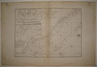
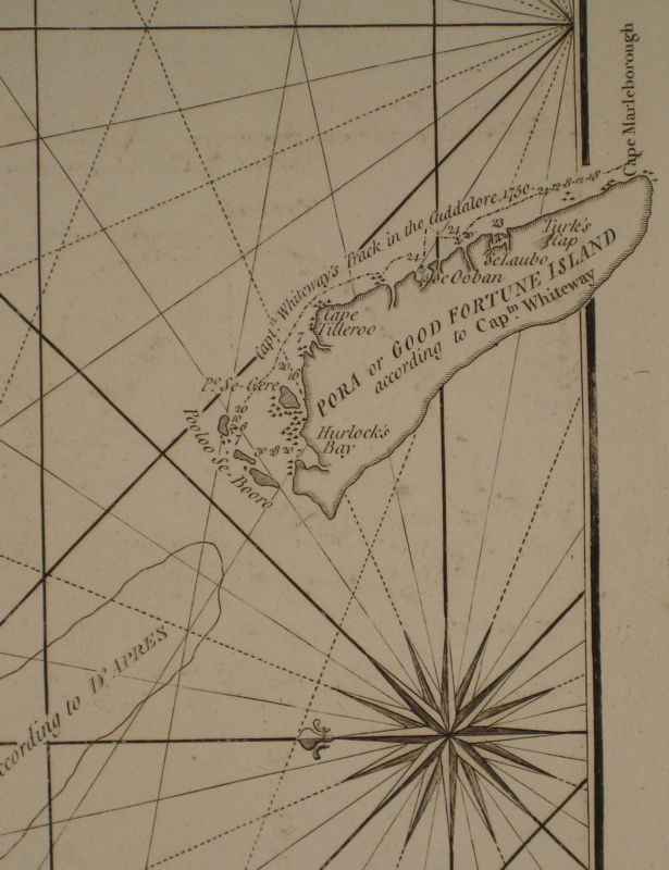
London: Laurie & Whittle, 1799. unbound. very good. Sea chart. Uncolored copper plate engraving. Image measures 18 7/8" x 26.25".<br/><br/> Beautiful chart of the central western coast of Sumatra. Includes rhumb lines, depths and shoals, the paths of previous explorations, a compass rose and three inset maps: "Se-Leaga Bay", "Tappanooly Bay" and "Plan of Nattal", the last of which includes sailing notes by Sampson Hall. The coast lines are further illustrated with with several topographical cross sections. Published in "The East-India Pilot, or Oriental Navigator, on One Hundred and Eighteen Plates: Containing a Complete Collection of Charts and Plans, &c..." (plate 90). Maps are based on the 1745 French "Neptune Oriental" by Jean Baptiste Nicolas Denis d'Apres de Mannevillette. The later English editions include additions by Captain Joseph Huddart and Sampson Hall. Minor dampstaining and offsetting with some stains to upper corners and along centerfold. Full original margins.<br/><br/>
Reviews
(Log in or Create an Account first!)
Details
- Bookseller
- Argosy Book Store
 (US)
(US)
- Bookseller's Inventory #
- 220053
- Title
- A Chart of the Western Coast of Sumatra from Touroumane to Indrapour with the Adjacent Islands
- Author
- LAURIE & WHITTLE
- Format/Binding
- Unbound
- Book Condition
- Used - very good
- Quantity Available
- 1
- Publisher
- Laurie & Whittle
- Place of Publication
- London
- Date Published
- 1799
- Keywords
- sea chart, blue back
Terms of Sale
Argosy Book Store
All items are offered net, subject to prior sale. Returns accepted within 7 days of receipt--please contact us first. Payment by Visa , Mastercard & American Express. Appropriate sales tax will be added for all N.Y. State residents
About the Seller
Argosy Book Store
Biblio member since 2004
New York, New York
About Argosy Book Store
We are a large retail store, with 6 floors of out-of-print and rare books, (including, Americana, modern first editions, history of medicine and science), antique maps and prints, autograph manuscripts, letters & signatures.
Glossary
Some terminology that may be used in this description includes:
This Book’s Categories

Mary Shelley - Mother of Science Fiction
“I have love in me the likes of which you can scarcely imagine and rage the likes of which you would not believe. If I cannot satisfy the one, I will indulge the other.” - Learn more about Mary Shelley, the author of Frankenstein

How to properly store your collection
Don't let a few small mistakes erode the value of your growing book collection. Review these tips to help preserve the beauty of your books!