Click for full-size.
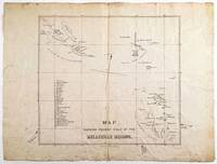
Map Shewing Present Field of the Melanesian Mission
- Used
- Condition
- See description
- Seller
-
Arrowsic, Maine, United States
Payment Methods Accepted
About This Item
Dunedin, New Zealand: J. Wilkie & Co., litho. [ca. 1880]. Lithograph, 30 x 33 cm, plus margins, mounted on original linen. CONDITION: Good, old folds, separation along central vertical fold in lower margin, with a bit of loss, light general foxing, minor losses and tears at edges.
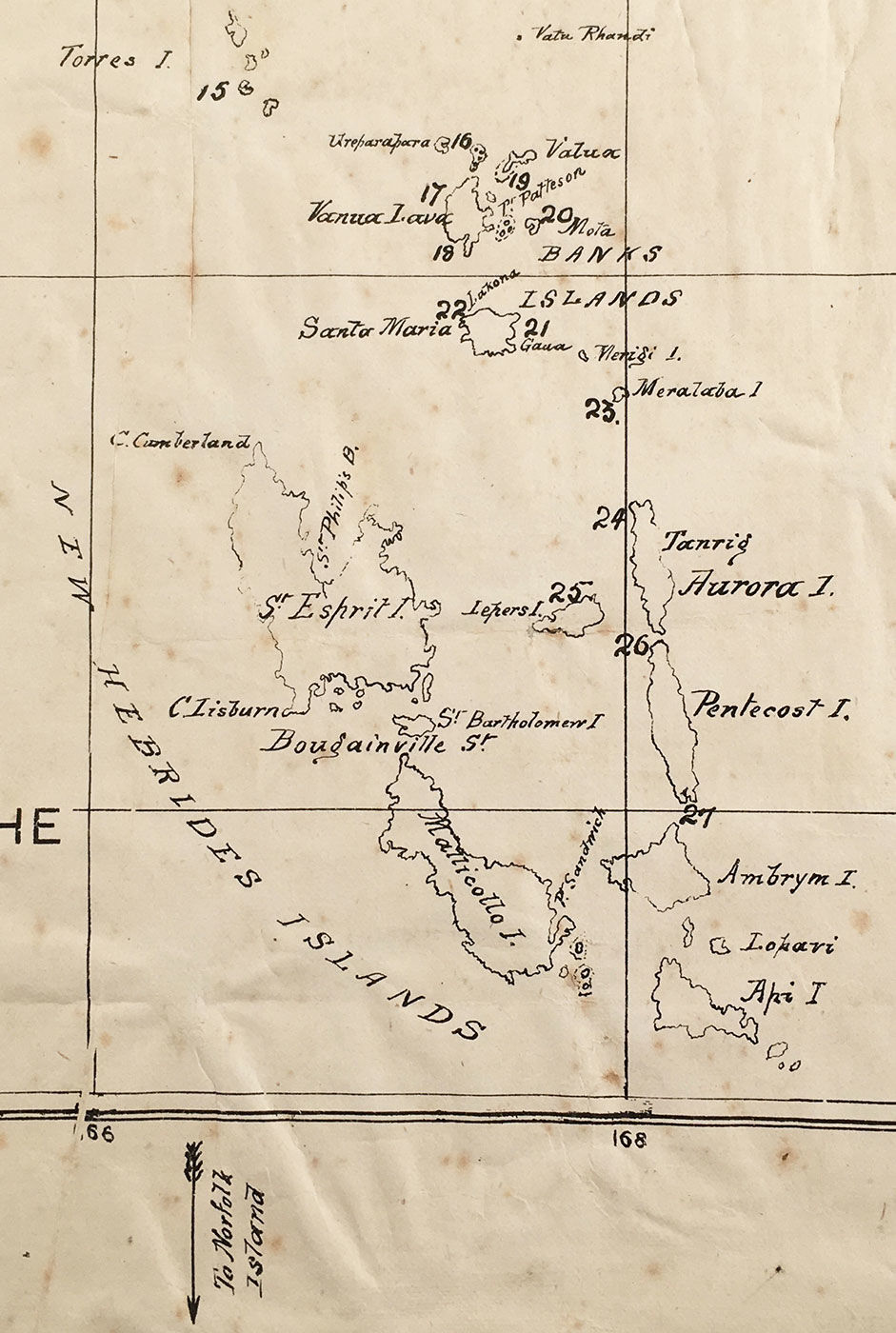
An apparently unrecorded map of the Solomon, Santa Cruz and New Hebrides Islands, which constituted the "field" of the Melanesian Mission spearheaded by English Bishop John Patteson, who met his end in the region at the hands of native people.
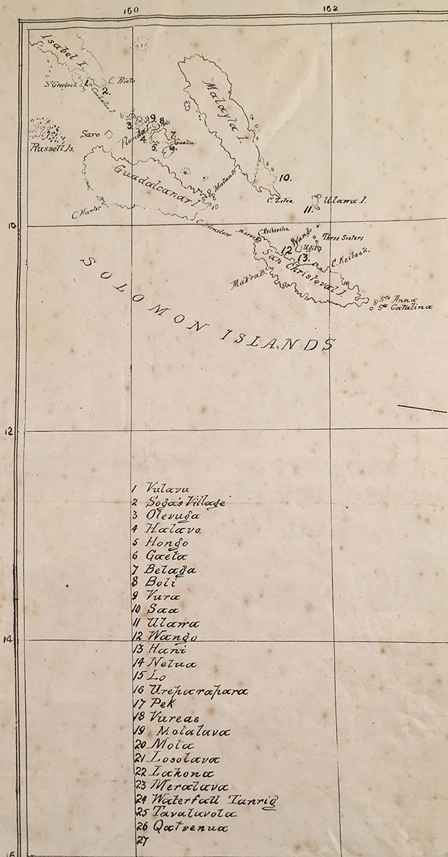
This map encompasses three clusters of islands in the South Pacific Ocean, all of which were of interest to the Melanesian Mission-an Anglican missionary agency established in 1854 on the recommendation of bishop of New Zealand, George Selwyn. Beginning with Vulava, twenty-six islands are listed and numbered at the bottom-left. Three arrows-located in the margins-point outside of the map proper to the Norfolk Islands, Fiji, and Sydney; compass lines appear in the center of the map. Some of the islands and locales labeled on the map do not appear in the list of islands.
In 1855, Englishman John Coleridge Patteson (1827-1871)-his mother the niece of Samuel Taylor Coleridge-became the Melanesian Mission's first bishop. In the course of his duties, Patteson learned some twenty-three Melanesian languages, which proved critical in his efforts to convert natives and also suppress the slave trade on the islands. In 1861 he became 'Bishop of Melanesia.' Sailing on the Southern Cross, Patteson traveled extensively throughout his island diocese-the "Present Field" depicted here spanning over 1,800 miles-and ferried converts back to study at his mission school.
Known for his gentle, agreeable temperament, Patteson is said to have been the first man to swim ashore to each new island the Southern Cross visited-arriving in shirt, pants and a top hat in which he kept presents. A note near the "Swallow Group" of islands identifies the spot where Patteson was killed by natives on the island of Nukapu on 20 Sept. 1871. Apparently Patteson was mistaken for a labor recruiter (an illegal 'blackbirder') disguised as a missionary. Near the spot where he was killed, another note reads "Patteson Sh[oals?]. P.D." Also named in his honor is Port Patteson, on the east coast of the Vanua Lava.
J. Wilkie & Co. Lithographers, Manufacturing and General Stationers, based in Dunedin, New Zealand, appears to have existed from at least the 1880s until 1922, when the company became Coulls Somerville Wilkie. Operating their own warehouse and stationery factory, Wilkie & Co. specialized in stationary, printing, bookbinding and embossing.
Not in OCLC.
REFERENCES: Patteson, John Coleridge (1827-) at Solomon Islands Historical Encyclopaedia online
Reviews
(Log in or Create an Account first!)
Details
- Seller
- James Arsenault & Company
 (US)
(US)
- Seller's Inventory #
- 5062
- Title
- Map Shewing Present Field of the Melanesian Mission
- Book Condition
- Used
- Quantity Available
- 1
- Publisher
- Dunedin, New Zealand: J. Wilkie & Co., litho. [ca. 1880]
- Weight
- 0.00 lbs
Terms of Sale
James Arsenault & Company
30 day return guarantee, with full refund including original shipping costs for up to 30 days after delivery if an item arrives misdescribed or damaged.
About the Seller
James Arsenault & Company
Biblio member since 2021
Arrowsic, Maine
About James Arsenault & Company
James Arsenault & Company was established in 1988. Our stock consists of Americana, literature, fine press, early photography, plate books, trade catalogs, autographs & manuscripts, ephemera, maps, and historical prints, as well as fine and rare books and pamphlets in a variety of fields. We are members in good standing of the ABAA and ILAB, and have exhibited for many years at numerous rare book fairs in both the northeast and in California. We do not have an open shop, but welcome your inquiries regarding items in our stock possibly of interest to you.
Glossary
Some terminology that may be used in this description includes:

How to tell if a signature is genuine
Author's signatures can undoubtedly increase the value of a rare book or first edition. The more scarce the book is, the more an autograph adds to its value. But how to tell if the signature is real? Find out how you can avoid common pitfalls in identifying an author's signature.

Beat Poet Michael McClure
From the fateful reading at Six-Gallery in 1955 to his novels, poetry, and stage productions, Michael McClure was right in the thick of the Beat Generation as it was born. See his books and art and learn more about the works of Michael McClure.